Atacama
Desert & Altiplano, Chile
Explorations in
Atacama
Activity
Difficulty
Areas
Lari
Cuenca del salar
-
 Horseback Ride
 -
Easy
-
Half-day
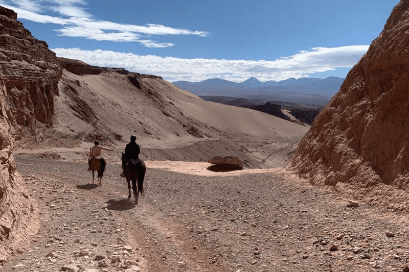
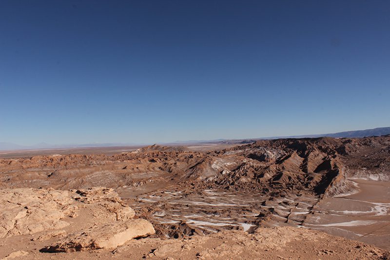
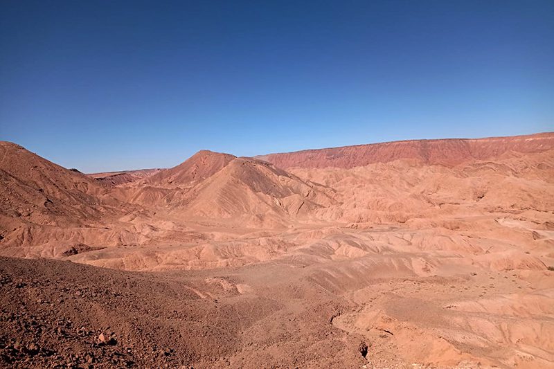
The reddish tones of the rock formations evoke distant horizons as we ride through the Mars Valley.
More details >Lari


-
Exploration Path
We begin the journey by vehicle toward the surroundings of the Valley of Mars, where we start our horseback ride through desert and eroded landscapes. The reddish tones of the rock formations evoke distant horizons as we ride through dunes and ravines. Guided by the Andes, we return to the lodge on horseback.
*Note: This exploration is not available on Mondays.
Selenita
Cuenca del salar
-
Horseback Ride
-
Easy
-
Half-day
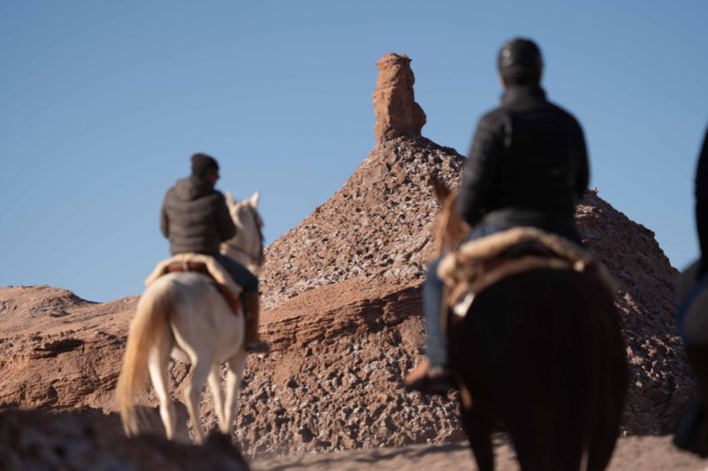
Ride through salt and gypsum formations in the Atacama Desert. Explore Vallecito near Moon Valley on horseback for a one-of-a-kind desert adventure.
More details >Selenita
-
Exploration Path
After a 45-minute drive to the Salt Mountain Range, we begin our horseback ride in a sector known as Vallecito, near the Moon Valley. We ride through formations of salt and gypsum, where the ground crunches beneath the hooves and the landscape reveals the unique geology of this mineral range. We return to the hotel by van at the end of the ride.
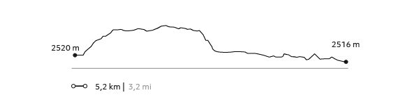
64 m 210 ft
-64 m -210 ft
2474 m 8117 ft
2440 m 8005 ftElevation Profile
Puri
Quebradas Intermedias
-
Overland
-
Easy
-
Half-day
Puri's overland exploration follows the Vilama and Puritama Rivers. Scenic viewpoints lead to a short hike into the Puritama Canyon.
More details >Puri

-
Exploration Path
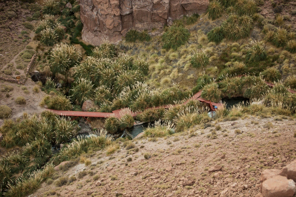
Puri's overland exploration follows the Vilama and Puritama Rivers, vital lifelines in the Atacama Desert. Stops at scenic viewpoints lead to a short hike into the Puritama Canyon, revealing unique vegetation and ancient human traces, and ending with a relaxing dip in our exclusive pools at the Puritama Hot Springs.
87 m 285 ft
-53 m -174 ft
3540 m 11614 ft
3474 m 11398 ftElevation Profile
Caspana
Altiplano
-
E-Bike
-
Advanced
-
Full-day
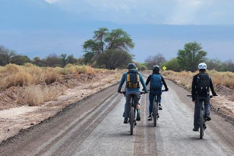
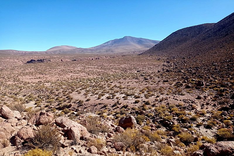
The E-Bike Caspana exploration traverses the striking contrasts of the Altiplano through ancient caravan routes connecting the Tocorpuri plains with Caspana and the Alto Loa region.
More details >Caspana


-
Exploration Path
The E-Bike Caspana exploration follows the ancient caravan routes that connected the Tocorpuri plains with Caspana and the Alto Loa region, as cyclists traverse striking contrasts of the Altiplano: towering volcanoes, arid and seasonal waterways.
342 m 1.122 ft
-1.420 m -4.659 ft
4.484 m 14.711 ft
3.248 m 10.656 ftElevation Profile
Vilama
Cuenca del salar

-
E-Bike
-
Expert
-
Half-day
This exploration leads to the Vilama Pukara viewpoint, where you'll uncover the remains of a Likan Antay fortress, once vital for safeguarding fertile lands and the river delta of the Vilama River
More details >Vilama

-
Exploration Path
This exploration leads to the Vilama Pukara viewpoint, where you'll uncover the remains of a Likan Antay fortress, once vital for safeguarding fertile lands and the river delta of the Vilama River—offering a glimpse into the region’s ancient defensive strategies.
822 m 2.697 ft
-822 m -2.697 ft
2.727 m 8.947 ft
2.430 m 7.972 ftElevation Profile
Oasis
Cuenca del salar
-
E-Bike
-
Easy
-
Half-day
The Oasis E-bike exploration uncovers the ancient settlements of the Licanantay culture in the Atacama Desert.
More details >Oasis
-
Exploration Path
The Oasis E-bike exploration uncovers the ancient settlements of the Licanantay culture in the Atacama Desert. Discover sites like the Tulor settlement in the Ayllu de Coyo, the Puribeter Elemental Reserve, and the Desert Library, blending history, nature, and local culture.
146 m 479 ft
-145 m -476 ft
2431 m 7976 ft
2376 m 7795 ftElevation Profile
Cejar
Cuenca del salar
-
Overland
-
Easy
-
Half-day
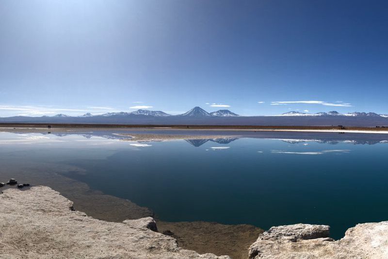
The Atacama Salt Flat is an endorheic basin with highly saline water outcrops, one of which is the Cejar Lagoon. We will venture into the northern part of the salt flat, surrounded by the vastness and accompanied by the Andean volcanoes. Once at Cejar, we will be able to enter its waters and float in the middle of the driest desert in the world.
*Please note: Not available on Tuesdays.
Cejar
-
Exploration Path
The Atacama Salt Flat is an endorheic basin with highly saline water outcrops, one of which is the Cejar Lagoon. We will venture into the northern part of the salt flat, surrounded by the vastness and accompanied by the Andean volcanoes. Once at Cejar, we will be able to enter its waters and float in the middle of the driest desert in the world.
*Please note: Not available on Tuesdays.
Camino del agua
Cuenca del salar
-
Hike
-
Easy
-
Half-day
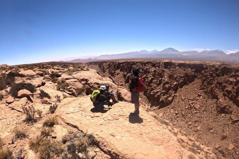
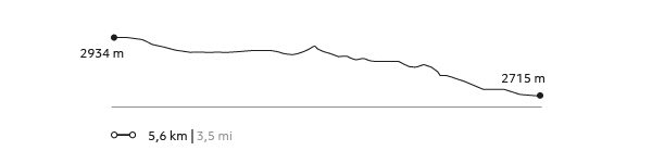
We will travel into the interior of the desert where nature and history blend. We will walk inside an incredible and gigantic canyon, an arm eroded by the water of the San Pedro River that flows within it. We will arrive at a sector with a great quantity of petroglyphs, as the place was a refuge for caravans. For most of the hike, we will be walking through water. *It is recommended to bring two pairs of shoes.
More details >Camino del agua

-
Exploration Path
We will travel into the interior of the desert where nature and history blend. We will walk inside an incredible and gigantic canyon, an arm eroded by the water of the San Pedro River that flows within it. We will arrive at a sector with a great quantity of petroglyphs, as the place was a refuge for caravans. For most of the hike, we will be walking through water.
*It is recommended to bring two pairs of shoes.
Quebrada de Chulacao
Cuenca del salar
-
Hike
-
Easy
-
Half-day
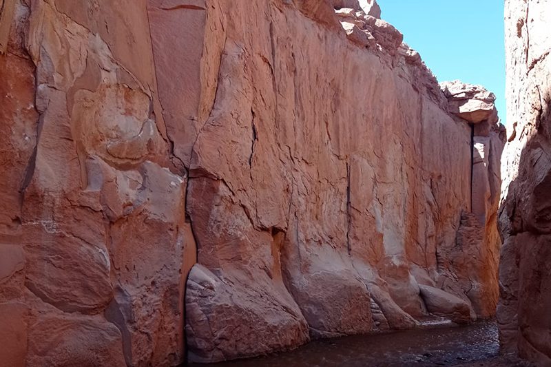
At the foot of the Salt mountains, we come to the Catarpe Valley, which receives the San Pedro river that feeds the oasis and the salt marsh. In the valley, we will begin our hike in the Quebrada Chulaco, a great canyon with high walls, with curves and serpentine shapes formed by moldable minerals and water erosion. Upon leaving the canyon we will hike up to a viewpoint with 360° views of the desert and its mountain ranges. We return along the same trail.
More details >Quebrada de Chulacao
-
Exploration Path
At the foot of the Salt mountains, we come to the Catarpe Valley, which receives the San Pedro river that feeds the oasis and the salt marsh. In the valley, we will begin our hike in the Quebrada Chulaco, a great canyon with high walls, with curves and serpentine shapes formed by moldable minerals and water erosion. Upon leaving the canyon we will hike up to a viewpoint with 360° views of the desert and its mountain ranges. We return along the same trail.
156 m 512 ft
-156 m -512 ft
2.582 m 8.471 ft
2.515 m 8.251 ftElevation Profile
Ronque
Quebradas Intermedias
-
Hike
-
Moderate
-
Full-day
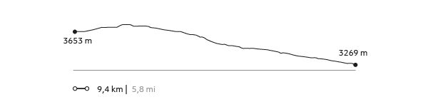
The hike begins in the upper part of Quebrada Jorquencal, a sector with large cacti and archaeological ruins. From there we descend to the Puritama hot springs. We will enjoy lunch there, before continuing our hike along the Puritama River, in a beautiful canyon of native vegetation home to dozens of birds. Our hike ends in the town of Guatín, where the Puritama and Purifica Rivers converge and give life to the Vilama River.
More details >Ronque

-
Exploration Path
The hike begins in the upper part of Quebrada Jorquencal, a sector with large cacti and archaeological ruins. From there we descend to the Puritama hot springs. We will enjoy lunch there, before continuing our hike along the Puritama River, in a beautiful canyon of native vegetation home to dozens of birds. Our hike ends in the town of Guatín, where the Puritama and Purifica Rivers converge and give life to the Vilama River.
161 m 528 ft
-545 m -1788 ft
3732 m 12241 ft
3269 m 10722 ftElevation Profile
Domeyko
Quebradas Intermedias
-
Hike
-
Moderate
-
Half-day
This hike takes place in the Domeyko range, amid great canyons and colors created by the different minerals that make up this mountain range. After getting lost among huge clay walls, we will descend some challenging steps product of the erosion caused by ancient seasonal rivers, and where we will have to use our hands. *Exploration not recommended for people with vertigo or fear of heights.
More details >Domeyko
-
Exploration Path
This hike takes place in the Domeyko range, amid great canyons and colors created by the different minerals that make up this mountain range. After getting lost among huge clay walls, we will descend some challenging steps product of the erosion caused by ancient seasonal rivers, and where we will have to use our hands.
*Exploration not recommended for people with vertigo or fear of heights.
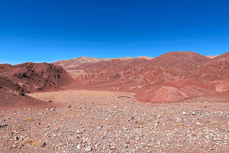
73 m 240 ft
-292 m -958 ft
2.934 m 9.626 ft
2.715 m 8.907 ftElevation Profile
Tambores
Quebradas Intermedias
-
Hike
-
Easy
-
Half-day
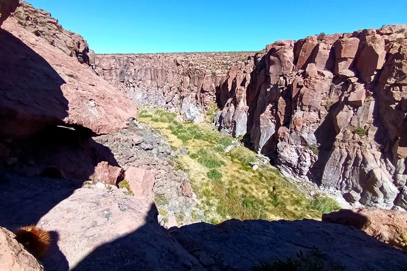
This hike explores the center of the Puritama Conservation Reserve, an area characterized by its great variety of cacti. Along the way we will have a view of the beautiful Quebrada Jorquenal from above, a canyon full of contrasts, vegetation, life and archaeological remains. We descend along a rocky terrain until reaching the Puritama hot springs.
More details >Tambores
-
Exploration Path
This hike explores the center of the Puritama Conservation Reserve, an area characterized by its great variety of cacti. Along the way we will have a view of the beautiful Quebrada Jorquenal from above, a canyon full of contrasts, vegetation, life and archaeological remains. We descend along a rocky terrain until reaching the Puritama hot springs.
118 m 387 ft
-233 m -764 ft
3732 m 12241 ft
3537 m 11601 ftElevation Profile
Caravaneros
Cuenca del salar
-
Hike
-
Easy
-
Half-day
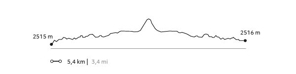
This hike is a journey through the history of the old caravans and their interaction with the desert. We will cross from the Vilama sector toward the Catarpe Valley along old desert trails until reaching the great canyons in Quebrada Chulaco. This hike gives us broad 360° views that will allow us to understand the desert's different areas and formations.
More details >Caravaneros
-
Exploration Path
This hike is a journey through the history of the old caravans and their interaction with the desert. We will cross from the Vilama sector toward the Catarpe Valley along old desert trails until reaching the great canyons in Quebrada Chulaco. This hike gives us broad 360° views that will allow us to understand the desert's different areas and formations.
159 m 522 ft
-183 m -600 ft
1617 m 5304 ft
2515 m 8249 ftElevation Profile
Astronomia Andina
Cielo
-
Sky
-
Easy
-
Half-day
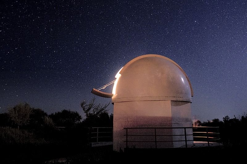
With our SmartScope, you can even capture real-time images of the cosmos: a window into the universe, framed by the high desert sky.
More details >Astronomia Andina

-
Exploration Path
It takes place almost every day at Explora. We begin with a briefing of basic concepts under the open sky. We then learn about orientation, distances, and local culture under one the world’s clearest skies. In our own observatory, we get to watch stellar objects in the solar system and deep space. Ask our guides for availability.
Now with our SmartScope, you can even capture real-time images of the cosmos: a window into the universe, framed by the high desert sky.
*Each traveler has the option to attend one astronomy exploration per stay. A second session will be subject to availability.
Ckausama
Altiplano
-
Overland
-
Easy
-
Full-day
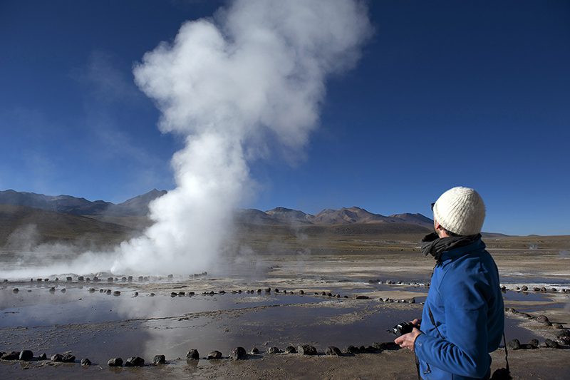
We take a van to the Tatio Geysers. Along the way, an important part of the Andean Plateau fauna –including vicuñas, flamingos, foxes...
More details >Ckausama
-
Exploration Path
We take a van to the Tatio Geysers. Along the way, an important part of the Andean Plateau fauna –including vicuñas, flamingos, foxes, and others– can be appreciated. We walk across the reserve feeling the inner activity of the land with views to the Andes Mountain Range and the hot water springs from where steam rises. We return by van.
-
Other options: