Atacama
Desert & Altiplano, Chile
Explorations in
Atacama
Activity
Difficulty
Areas
Solor
Cuenca del salar
-
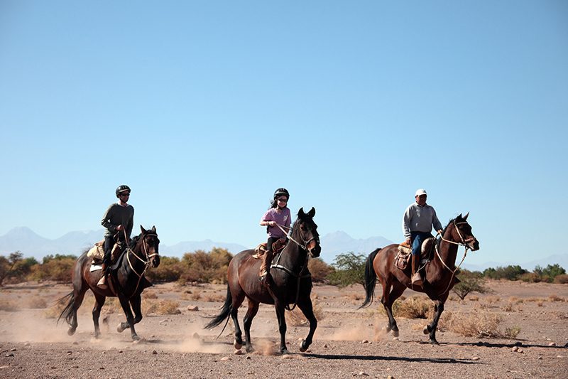
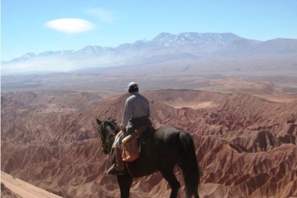
 Horseback Ride
 -
Easy
-
Half-day
We travel to the ayllu in Solor, located to the south of San Pedro. Here we can see one of the oasis’s most developed farming areas...
More details >Solor


-
Exploration Path
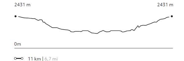
We travel to the ayllu in Solor, located to the south of San Pedro. Here we can see one of the oasis’s most developed farming areas. On our way, we can see typical desert constructions –using adobe and straw roofs– and we go across a small irrigation canal. Before we return, we visit the mythical Librería del desierto.
64 m 211 ft
-64 m -211 ft
2.431 m 7.974 ft
2.400 m 7.872 ftElevation Profile
Dunas de la Chula
Cuenca del salar
-
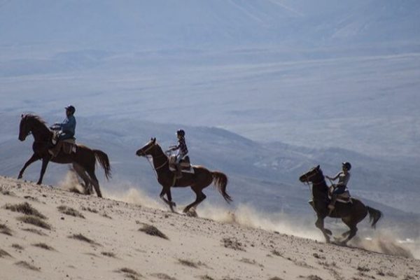
Horseback Ride
-
Easy
-
Half-day
We horseback ride to the Salt Mountain Range. We go across the San Pedro River and sand dunes, from where we have panoramic views...
More details >Dunas de la Chula
-
Exploration Path
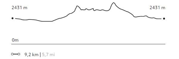
We horseback ride to the Salt Mountain Range. We go across the San Pedro River and sand dunes, from where we have panoramic views of the Andes Mountain Range and the oasis. Afterwards, we follow through a dry riverbed and comeback to Explora through the pampa.
114 m 374 ft
-114 m -374 ft
2.481 m 8.140 ft
2.410 m 7.907 ftElevation Profile
Valle de Marte
Cuenca del salar
-
Horseback Ride
-
Advanced
-
Half-day
We leave the hotel to go to the Mars Valley, where we horseback ride among typical desert landscapes: dunes...
More details >Valle de Marte

-
Exploration Path
We leave the hotel to go to the Mars Valley, where we horseback ride among typical desert landscapes: dunes, reddish sedimentary rock formations and clay grounds. This exploration is perfect to get an idea of the geography and origin of the Salt Ridge.
For experienced and advanced riders only. This exploration is only available for advanced riders who have mastered rising trot and canter over uneven terrain in open spaces and on all types of horses. A test in the hotel is required before going out into the desert. Please note: Not available on Mondays.
237 m 778 ft
-237 m -778 ft
2.556 m 8.386 ft
2.428 m 7.966 ftElevation Profile
Beter
Cuenca del salar
-
Horseback Ride
-
Advanced
-
Half-day
In this exploration, we visit the two ayllus, ancient Atacameño farm communities, where we can see the local lifestyle...
More details >Beter
-
Exploration Path
In this exploration, we visit the two ayllus, ancient Atacameño farm communities, where we can see the local lifestyle, vegetable gardens and archeological remains. To begin, we will go to the ayllu in Solor. Next we continue to the ayllu dunes of Beter, one of the first Atacameño settlement.
For experienced and advanced riders only. This exploration is only available for advanced riders who have mastered rising trot and canter over uneven terrain in open spaces and on all types of horses. A test in the hotel is required before going out into the desert.
106 m 348 ft
-106 m -348 ft
2.431 m 7.974 ft
2.388 m 7.833 ftElevation Profile

Piedra de la Coca
Cuenca del salar
-
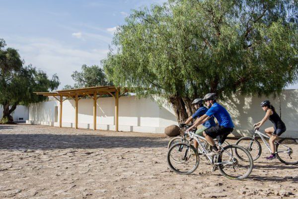
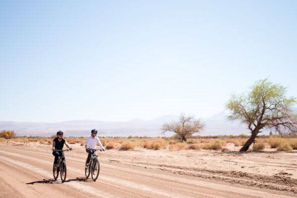
E-Bike
-
Moderate
-
Half-day
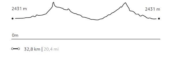
We leave by bicycle to Catarpe through a road that goes up to the Salt Mountain Range. We go through an ancient tunnel...
More details >Piedra de la Coca


-
Exploration Path
We leave by bicycle to Catarpe through a road that goes up to the Salt Mountain Range. We go through an ancient tunnel before starting a descent that will take us to the Piedra de la Coca, a site with petroglyphs. We continue our trip to the Paciencia plains through stony grounds and on our way back we pass through the Mars Valley.
560 m 1836,8 ft
-560 m -1837 ft
2.642 m 8.666 ft
2.431 m 7.974 ftElevation Profile
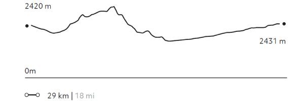
Ckuta
Cuenca del salar
-
E-Bike
-
Easy
-
Half-day
We take a van to the Salt Mountain Range and begin bike riding in the Paciencia plains. We travel to the Moon Valley through...
More details >Ckuta
-
Exploration Path
We take a van to the Salt Mountain Range and begin bike riding in the Paciencia plains. We travel to the Moon Valley through sandy soil and beautiful landscapes. The return trip is an uneven path that includes different ascents and descents.
251 m 823 ft
-240 m -787 ft
2.488 m 8.163 ft
2.366 m 7.762 ftElevation Profile
-
Other options: