Patagonia National Park
Patagonia, Chile
Explorations in
Patagonia National Park
Activity
Difficulty
Areas
Valles Glaciares
The Uplands
-
 By air
 -
Easy
-
Half-day
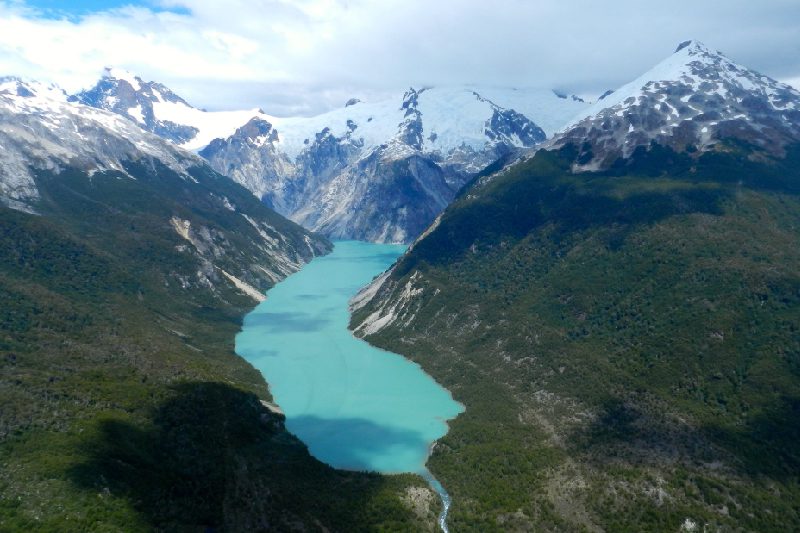
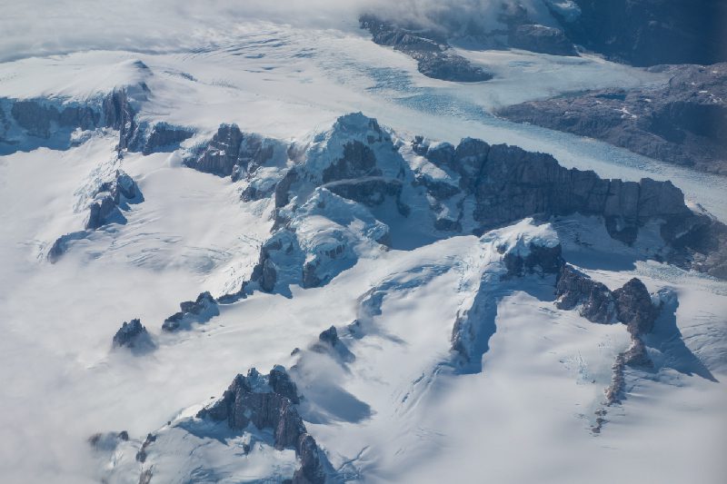
An exploration that reveals the scale of the Northern Patagonian Ice Field from the air.
More details >Valles Glaciares


-
Exploration Path
A flight that reveals the scale of the Northern Patagonian Ice Field from the air. We follow the Nef valley upstream until the first views of the ice appear, with Mount San Valentín rising clearly on the horizon. From there, the landscape connects naturally toward the Colonia and Leones valleys, showing how glaciers link with the lakes and rivers that eventually drain into Lake Bertrand. A direct way to understand this system of mountains, ice, and water.
*Private journey with an additional cost and subject to availability.
Contact our reservations team for more details at reserve@explora.com or by phone at +56 2 2395 2800.
Baker
Waters
-
Overland
-
Easy
-
Half-day
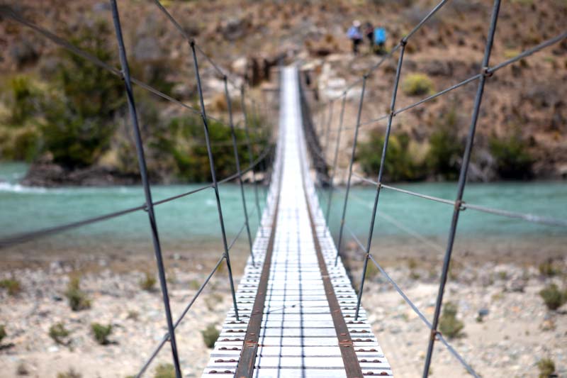
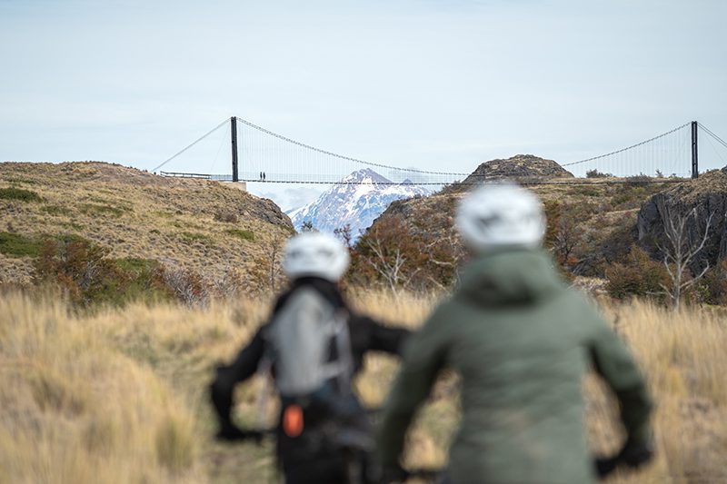
A full-day exploration of the Baker River begins at its outflow, where it empties its turquoise waters into the waters of Lake General Carrera. An overland journey leads us along the river, allowing us to discover the dynamic landscapes and transitions, crossing suspended bridges and tracing the river’s path to the sea, appreciating views of snow-capped peaks and ancient settlements.
More details >Baker

-
Exploration Path
A full-day exploration of the Baker River begins at its outflow, where it empties its turquoise waters into the waters of Lake General Carrera. An overland journey leads us along the river, allowing us to discover the dynamic landscapes and transitions, crossing suspended bridges and tracing the river’s path to the sea, appreciating views of snow-capped peaks and ancient settlements.
Lago Gutierrez
Veranadas
-
Hike
-
Moderate
-
Half-day
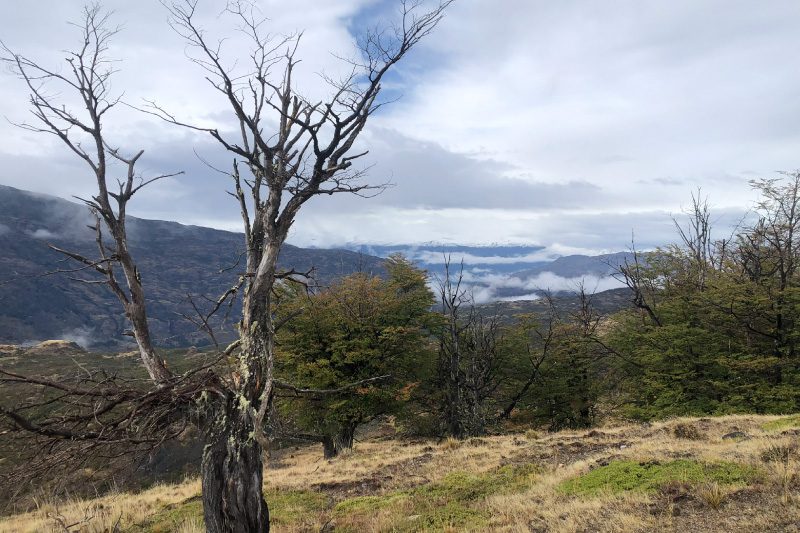
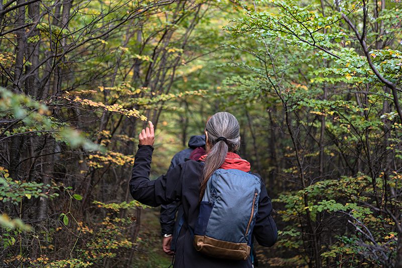
This walking route recreates the ancient pathways of the Aonikenk, hunter-gatherers of Patagonia who roamed the pampas of the Chacabuco Valley thousands of years ago. Their traces endure in the petroglyphs of the Cueva de los Niños, located near the trail. The route culminates at Lago Gutiérrez, the largest in the Chacabuco Valley, which served as a resting site for the long journeys of nomadic Patagonian communities.
More details >Lago Gutierrez


-
Exploration Path
This walking route recreates the ancient pathways of the Aonikenk, hunter-gatherers of Patagonia who roamed the pampas of the Chacabuco Valley thousands of years ago. Their traces endure in the petroglyphs of the Cueva de los Niños, located near the trail. The route culminates at Lago Gutiérrez, the largest in the Chacabuco Valley, which served as a resting site for the long journeys of nomadic Patagonian communities.
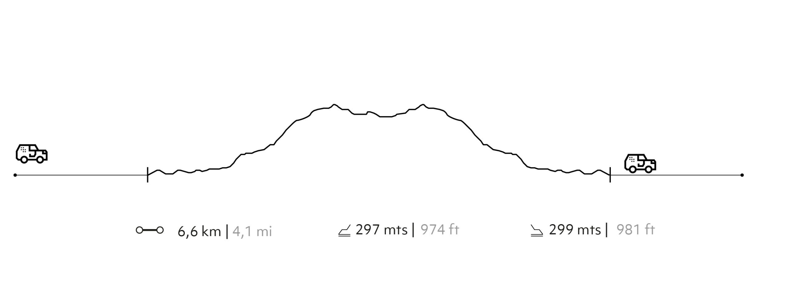
299 m 981 ft
-299 m -981 ft
538 m 1.765 ft
382 m 1.253 ftElevation Profile
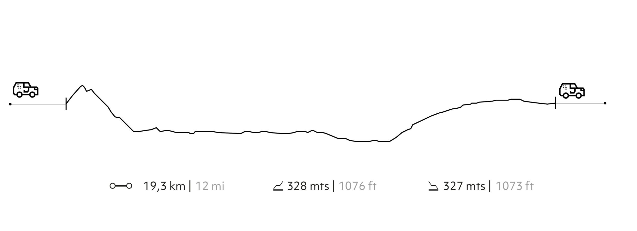
Tres Puentes
The Historic Valley
-
E-Bike
-
Moderate
-
Half-day
A dynamic e-bike ride along the winding slopes of the eastern Chacabuco Valley. Discover diverse landscapes ranging from expansive pampas and patches of ñirre and lenga forests to water bodies once used as rest stops for livestock transhumance, making this circuit filled with viewpoints a must-see for cycling and outdoor enthusiasts.
More details >Tres Puentes

-
Exploration Path
A dynamic e-bike ride along the winding slopes of the eastern Chacabuco Valley. Discover diverse landscapes ranging from expansive pampas and patches of ñirre and lenga forests to water bodies once used as rest stops for livestock transhumance, making this circuit filled with viewpoints a must-see for cycling and outdoor enthusiasts.
328 m 1.076 ft
-328 m -1.076 ft
525 m 1.722 ft
305 m 1.001 ftElevation Profile
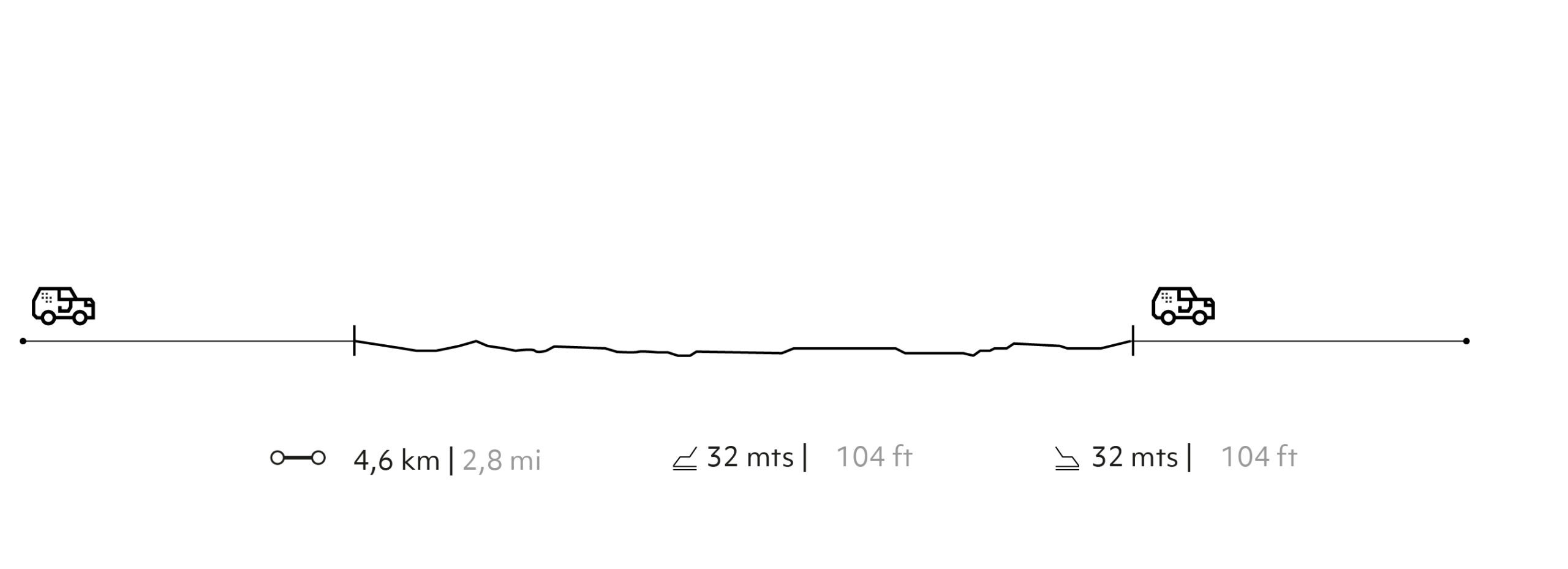
El Furioso
The Historic Valley
-
Hike
-
Easy
-
Half-day
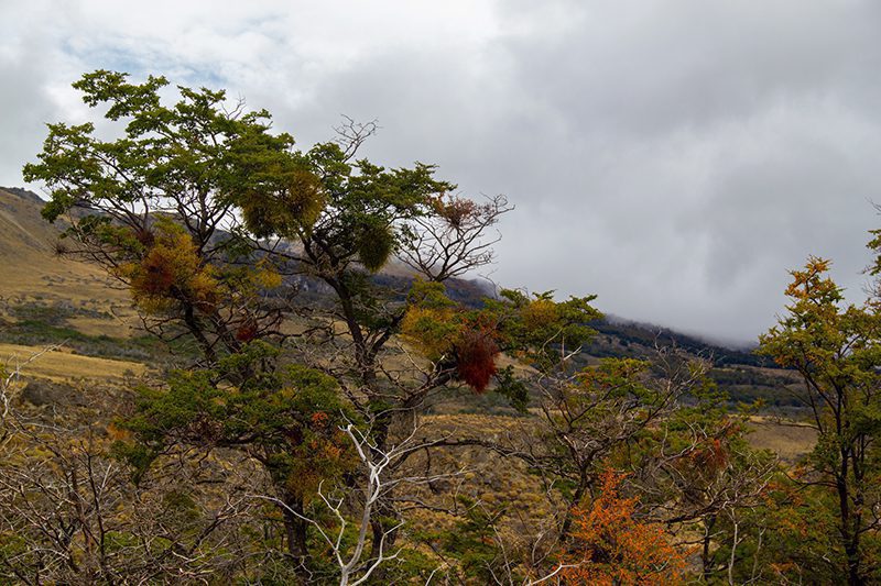
This trail offers stunning views of the Pampa Guanaco sector, with its iconic mountain formations that define the valley. Along the route, you'll encounter glaciolacustrine terraces that, thousands of years ago, provided refuge for hunter-gatherer societies that inhabited the eastern Patagonian region of Aysén.
El Furioso
-
Exploration Path
This trail offers stunning views of the Pampa Guanaco sector, with its iconic mountain formations that define the valley. Along the route, you'll encounter glaciolacustrine terraces that, thousands of years ago, provided refuge for hunter-gatherer societies that inhabited the eastern Patagonian region of Aysén.
32 m 104 ft
-32 m -104 ft
352 m 1.155 ft
336 m 1.102 ftElevation Profile
Fly Fishing in the Baker River
Waters
-
By water
-
Easy
-
Half-day
We travel to Puerto Bertrand to embark on a cataraft along the Baker River. Surrounded by lush forests, turquoise waters, and snow-capped mountains, we begin our journey and fly-fishing adventure, aiming to catch the emblematic Patagonian trout using traditional fly-fishing techniques.
More details >Fly Fishing in the Baker River

-
Exploration Path
We travel to Puerto Bertrand to embark on a cataraft along the Baker River. Surrounded by lush forests, turquoise waters, and snow-capped mountains, we begin our journey and fly-fishing adventure, aiming to catch the emblematic Patagonian trout using traditional fly-fishing techniques.
*Exploration provided by an external operator and at an additional cost.
* This exploration can be done in 5 hours or 8 hours depending on your preferences.
Contact our reservations team for more details at reserve@explora.com or by phone at +56 2 2395 2800.
Northern Patagonian Ice Field
The Uplands
-
By air
-
Easy
-
Half-day
Discover the stunning landscapes of the Northern Patagonian Ice Field from above, flying in helicopter over the Laguna San Rafael National Park. This unique exploration lets you experience the majestic glaciers, mountains, valleys, rivers, and lakes of Northern Patagonia from a new perspective.
More details >Northern Patagonian Ice Field
-
Exploration Path
A flight that reveals the true scale of southern Patagonia. We enter through the Colonia valley, leaving glacial lakes and ancient moraines below, until reaching the first extensions of the Northern Patagonian Ice Field. From the air, Mount San Valentín stands out as the dominant summit of the region, surrounded by vast masses of ice. The exit follows the Leones glacier, flying over its lake and tracing the natural flow of water toward the southern lakes. An experience that allows you to understand, in minutes, the size, forms, and remoteness of this landscape.
*Private journey with an additional cost and subject to availability.
Contact our reservations team for more details at reserve@explora.com or by phone at +56 2 2395 2800.
Borde Río
Waters

-
Combination
-
Moderate
-
Full-day
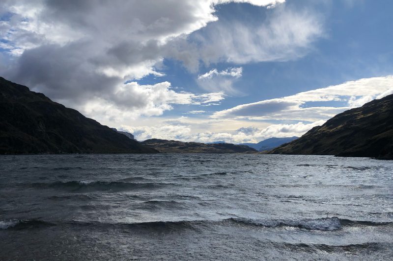
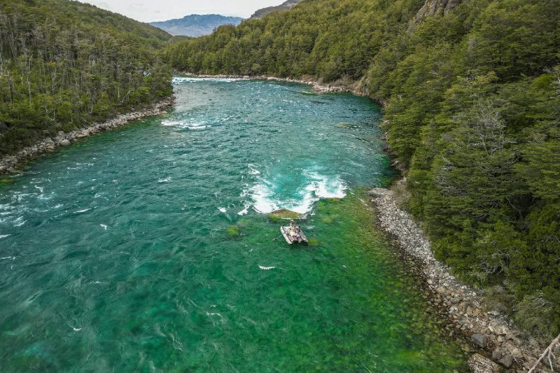
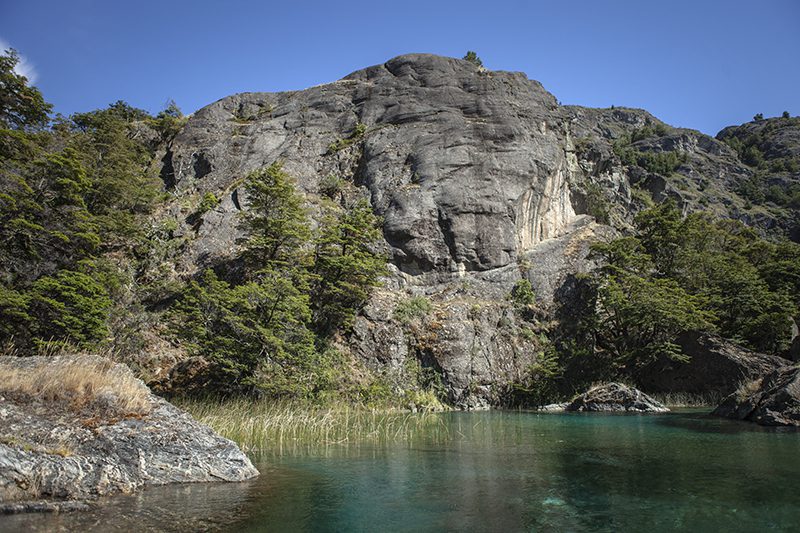
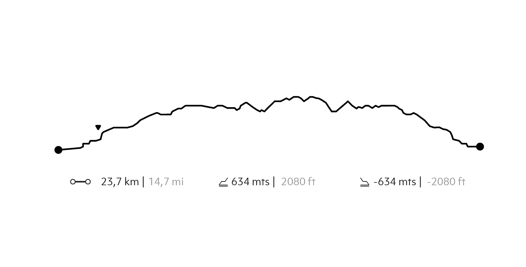
We leave by boat along the Cochrane river and lake basin, considered among the most crystalline waters in the world, until reaching the Correntadas sector, where we will hike along the southern slopes of the park through forests full of wildlife.
More details >Borde Río

-
Exploration Path
We leave by boat along the Cochrane river and lake basin, considered among the most crystalline waters in the world, until reaching the Correntadas sector, where we will hike along the southern slopes of the park through forests full of wildlife.
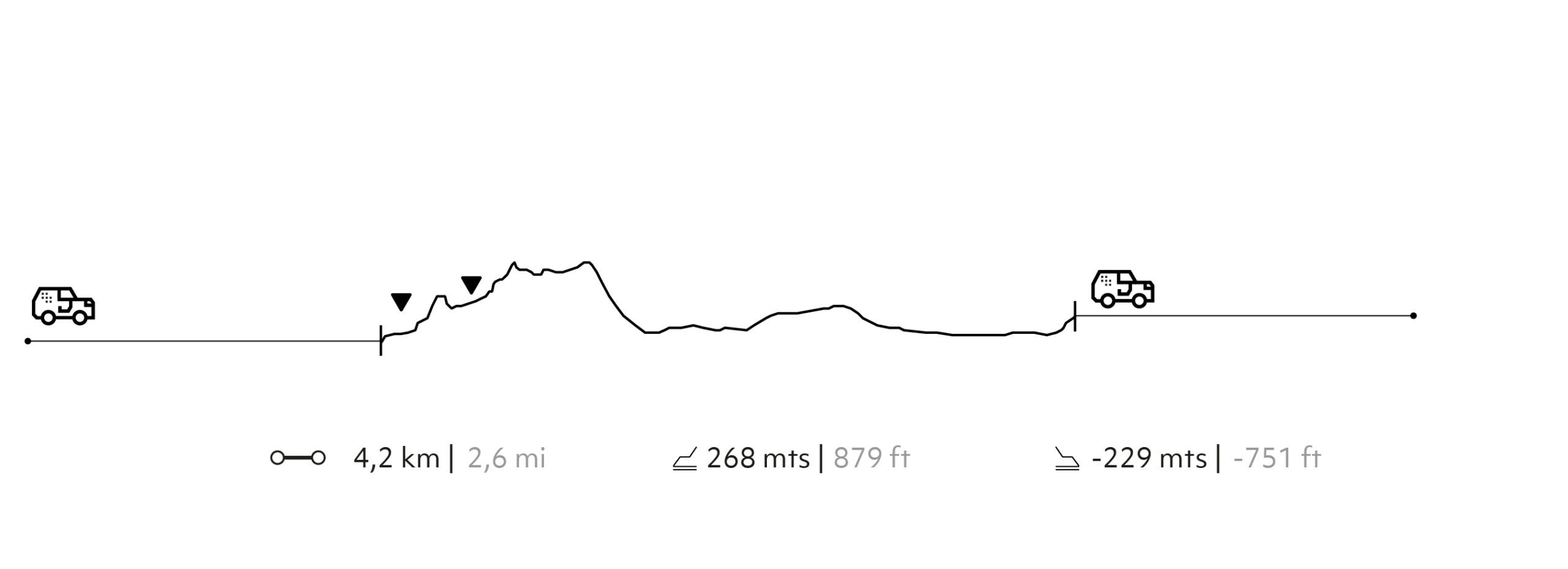
268 m 879 ft
-229 m -751 ft
253 m 830 ft
159 m 522 ftElevation Profile
Aguas Claras
Waters
-
By water
-
Easy
-
Half-day
We leave by boat along the Cochrane River and lake basin, considered among the most crystalline waters in the world, observing the valley walls that make up part of the park. Different nothofagus species and livestock can be observed in the Tamango sector.
More details >Aguas Claras
-
Exploration Path
We leave by boat along the Cochrane River and lake basin, considered among the most crystalline waters in the world, observing the valley walls that make up part of the park. Different nothofagus species and livestock can be observed in the Tamango sector.
Gran Pasarela
The Historic Valley
-
E-Bike
-
Moderate
-
Half-day
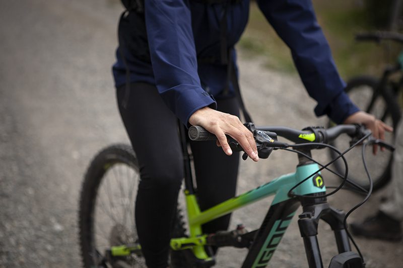
We will bike across much of the Chacabuco Valley and the Patagonian steppe, observing how it has been recovering its original nature little by little. We will then continue up to the great walkway donated by Mr. Butler and get to know its interesting construction.
More details >Gran Pasarela
-
Exploration Path
We will bike across much of the Chacabuco Valley and the Patagonian steppe, observing how it has been recovering its original nature little by little. We will then continue up to the great walkway donated by Mr. Butler and get to know its interesting construction.
295 m 968 ft
-295 m -968 ft
359 m 1.178 ft
239 m 784 ftElevation Profile
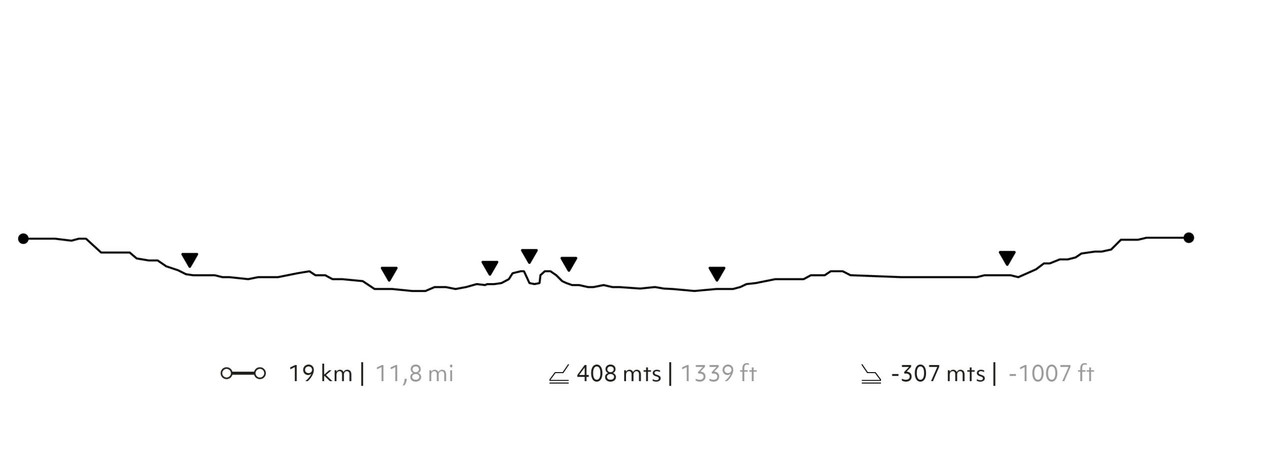
Laguna La Pepa
Veranadas
-
E-Bike
-
Moderate
-
Half-day
We will cycle along a trail with ascents and descents, from which we will see lagoons, ranches and nothofagus forests, until reaching Laguna La Pepa, which we will flank before returning along the same route.
More details >Laguna La Pepa
-
Exploration Path
We will cycle along a trail with ascents and descents, from which we will see lagoons, ranches and nothofagus forests, until reaching Laguna La Pepa, which we will flank before returning along the same route.
634 m 2.080 ft
-634 m -2.080 ft
646 m 2.119 ft
340 m 1.115 ftElevation Profile
Raices
Veranadas
-
Hike
-
Moderate
-
Half-day
We leave the lodge by van and head to the Laguna Edita sector, where we will begin our hike with a fairly steep hike up the steppe slopes of the Chacabuco Valley. After reaching the highest point, we will descend through a nothofagus forest where the silence is only interrupted by birdsong. In the end we reach Laguna Pepa, which surprises us with its deep blue color and views of the mountain ranges around it.
More details >Raices
-
Exploration Path
We leave the lodge by van and head to the Laguna Edita sector, where we will begin our hike with a fairly steep hike up the steppe slopes of the Chacabuco Valley. After reaching the highest point, we will descend through a nothofagus forest where the silence is only interrupted by birdsong. In the end we reach Laguna Pepa, which surprises us with its deep blue color and views of the mountain ranges around it.
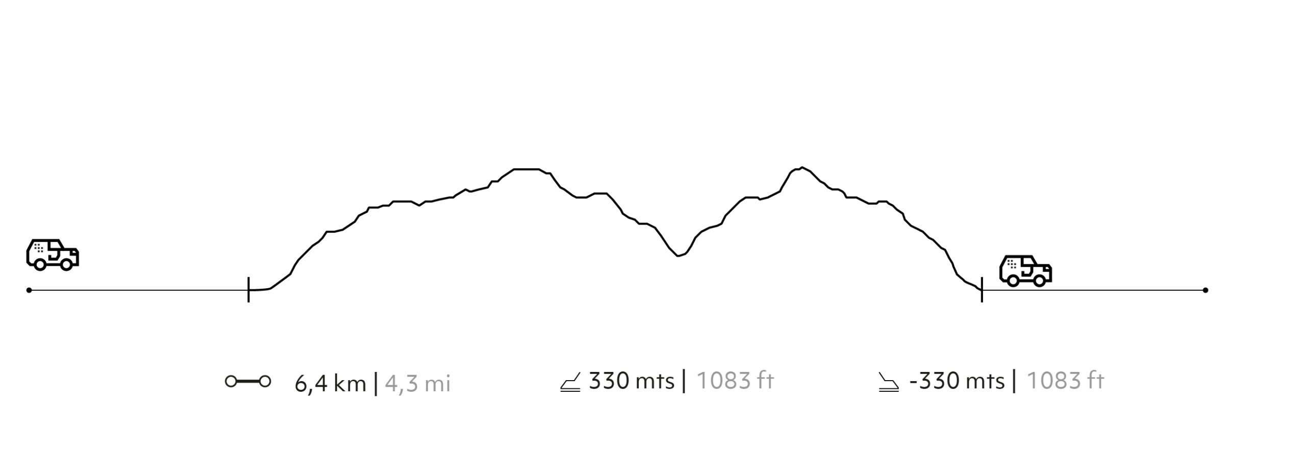
330 m 1.083 ft
-330 m -1.083 ft
741 m 2.431 ft
578 m 1.896 ftElevation Profile
La Valchac
The Historic Valley
-
Overland
-
Easy
-
Full-day
In this exploration we will focus on the Chacabuco River's valleys and route as a natural corridor traveled by nomadic peoples and diverse wildlife since ancestral times. We will discuss the anthropological and paleontological mysteries its rock formations hold, with caves and fossils that are vestiges of a past that it is still possible to bear witness to. These areas are characterized by their lack of snow in the summer and their low vegetation, devoid of trees. This allows you to observe a flat and open landscape where you can feel and live the icy southern wind. It is an experience among the vestiges of pre-Hispanic history and how they relate to the present and conservation.
More details >La Valchac
-
Exploration Path
In this exploration we will focus on the Chacabuco River's valleys and route as a natural corridor traveled by nomadic peoples and diverse wildlife since ancestral times. We will discuss the anthropological and paleontological mysteries its rock formations hold, with caves and fossils that are vestiges of a past that it is still possible to bear witness to. These areas are characterized by their lack of snow in the summer and their low vegetation, devoid of trees. This allows you to observe a flat and open landscape where you can feel and live the icy southern wind. It is an experience among the vestiges of pre-Hispanic history and how they relate to the present and conservation.
La Vega
The Historic Valley
-
Hike
-
Easy
-
Half-day
We leave the lodge on foot and take an introductory hike in Patagonia National Park on this exploration. We will begin in sectors where there are streams and low forests with significant presence of chacya (riparian shrub). As we enter the Park, we will begin to hear the songs of a variety of birds, such as churrin and bandurria tapaculo and black-faced ibis). Guanacos can be spotted grazing in this area.
More details >La Vega
-
Exploration Path
We leave the lodge on foot and take an introductory hike in Patagonia National Park on this exploration. We will begin in sectors where there are streams and low forests with significant presence of chacya (riparian shrub). As we enter the Park, we will begin to hear the songs of a variety of birds, such as churrin and bandurria tapaculo and black-faced ibis). Guanacos can be spotted grazing in this area.
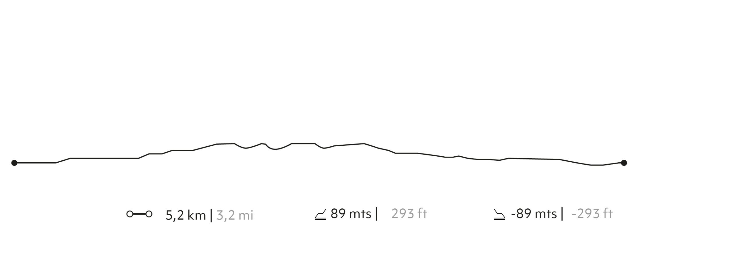
89 m 293 ft
-89 m -291 ft
388 m 1.273 ft
339 m 1.112 ftElevation Profile
Viaje Glaciar
The Uplands
-
Overland
-
Easy
-
Half-day
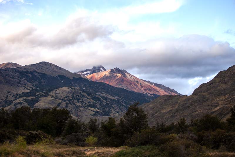
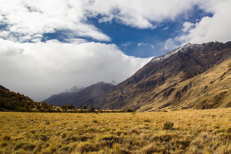
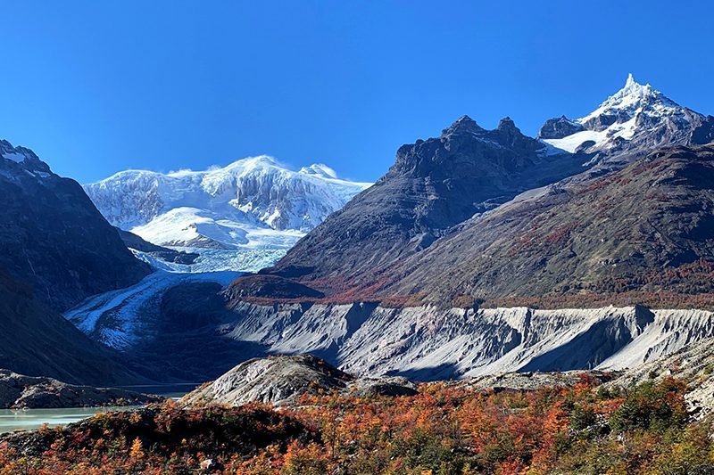
We depart from Explora on the Patagonia National Park and travel along the Carretera Austral until taking back roads amid forests, rivers and lagoons until reaching the Calluqueo Glacier. This impressive tongue of ice hangs from the western slope of the solemn Mount San Lorenzo. It then flows into a murky glacial lagoon surrounded by walls of ice thousands of years old that impose themselves on the geography of the place. It is a natural environment that was formed over the course of centuries and millennia, where the scale of time is blurred. The wind causes the clouds surrounding Mount San Lorenzo to put on a shifting and dynamic show. We will be able to sit down and contemplate, walk around, or go down to get our wet feet in the lagoon.
More details >Viaje Glaciar
-
Exploration Path
We depart from Explora on the Patagonia National Park and travel along the Carretera Austral until taking back roads amid forests, rivers and lagoons until reaching the Calluqueo Glacier. This impressive tongue of ice hangs from the western slope of the solemn Mount San Lorenzo. It then flows into a murky glacial lagoon surrounded by walls of ice thousands of years old that impose themselves on the geography of the place. It is a natural environment that was formed over the course of centuries and millennia, where the scale of time is blurred. The wind causes the clouds surrounding Mount San Lorenzo to put on a shifting and dynamic show. We will be able to sit down and contemplate, walk around, or go down to get our wet feet in the lagoon.
-
Other options: