Torres del Paine
Patagonia, Chile
Explorations in
Torres del Paine
Activity
Difficulty
Areas
FERRIER
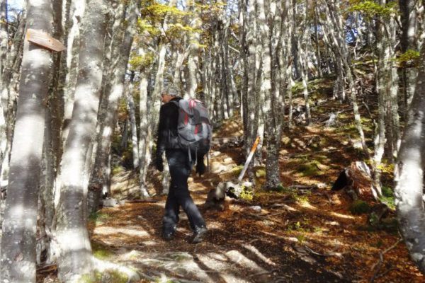
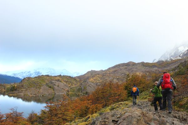
Bosque
-
 Hike
Hike -
Expert
-
Half-day
We travel by van to the Grey Lake where we begin a demanding ascent during which we get views of the Lake...
More details >FERRIER


-
Exploration Path
We travel by van to the Grey Lake where we begin a demanding ascent during which we get views of the Lake and the huge ice mass of the South Ice Fields. We cross a forest and continue to the top with panoramic views of the Grey and Pehoé lakes. We descend and return by van.
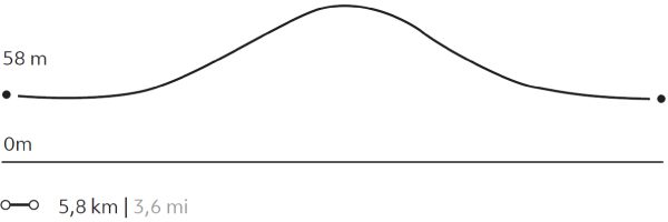
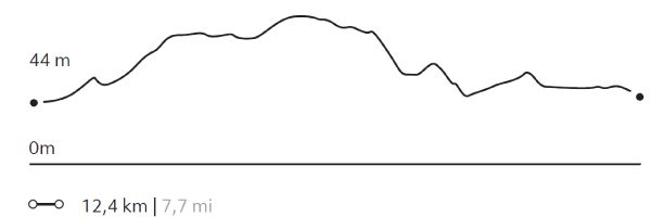
612 m 2.008 ft
-612 m -2.008 ft
642 m 2.106 ft
56 m 184 ftElevation Profile
VALLE DEL FRANCÉS
Glaciar
-
Hike
-
Moderate
-
Full-day
We cross the Pehoé Lake by catamaran to the Paine Grande refuge where we start the trek. We enter the Francés Valley...
More details >VALLE DEL FRANCÉS

-
Exploration Path
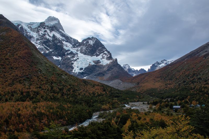
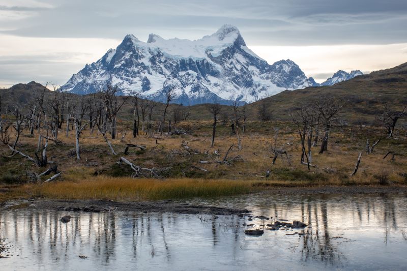
We cross the Pehoé Lake by catamaran to the Paine Grande refuge where we start the trek. We enter the Francés Valley through a forest, cross the suspension bridge over the Francés River and continue to the Italian Camp. From there, we see the glacier and the granite peaks that frame the area. We return by the same trail.
*Navigation is subject to weather.
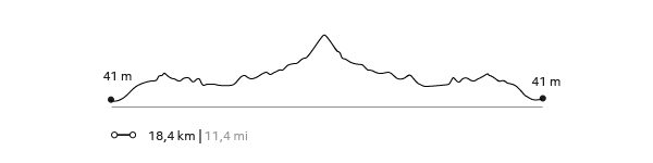
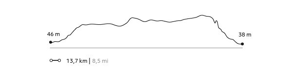
632 m 2.073 ft
-632 m -2.073 ft
275 m 902 ft
39 m 128 ftElevation Profile
GLACIAR GREY
Glaciar
-
Hike
-
Moderate
-
Full-day
We cross the Pehoé Lake by catamaran to the Paine Grande refuge to cross one of the stretches of the W. Around the midpoint...
More details >GLACIAR GREY
-
Exploration Path
We cross the Pehoé Lake by catamaran to the Paine Grande refuge to cross one of the stretches of the W. Around the midpoint of the hike, we can see the Grey Glacier and the Southern Ice Fields. We continue walking to the beach of Grey Lake where we board a boat that brings us to the glacier and then leaves us on the other side of the lake. We walk along the beach and through a forest to the van.
*Navigation is subject to the availability of Explora's external operator and the weather.
*For safety reasons, this exploration is available only between the months of September and April.
538 m 1.765 ft
-516 m -1.693 ft
273 m 896 ft
29 m 95 ftElevation Profile
ALTO DEL TORO
Encuentro
-
Hike
-
Moderate
-
Full-day
We travel by van to a steep path facing the Paine River. We begin our trek towards the mountain range passing through an old forest...
More details >ALTO DEL TORO
-
Exploration Path
We travel by van to a steep path facing the Paine River. We begin our trek towards the mountain range passing through an old forest. We continue ascending to an overlook with unparalleled views of the Paine massif and the lakes that surround it. Then, we begin the descent towards the van.
681 m 2.234 ft
-693 m -2.274 ft
411 m 1.348 ft
38 m 125 ftElevation Profile
-
Other options: