Torres del Paine
Patagonia, Chile
Explorations in
Torres del Paine
Activity
Difficulty
Areas
ESTEPA PATAGÓNICA
Estepa

-
 Overland
 -
Easy
-
Half-day
We travel through the eastern sector of the park combining stretches in van with short walks...
More details >ESTEPA PATAGÓNICA


-
Exploration Path
We travel through the eastern sector of the park combining stretches in van with short walks. This sector is mainly characterized by the presence of animals such as guanacos, pumas and diversity of birds, as well as its extensive pampas, typical of the Patagonian steppe. First we visit the Nordenskjöld Lake viewpoint and the Paine Grande waterfall, then we travel by van to the Los Cisnes Lagoon and finally to the Amarga Lagoon.
*Available only select months of the year according to the activity of the estancieros. Coordinated at the destination.
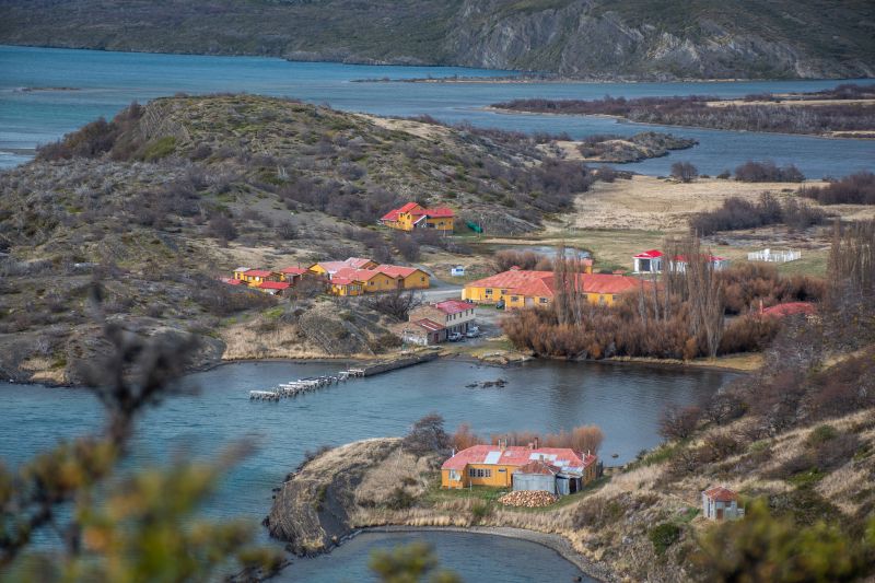
Aves Australes
Encuentro
-
Overland
-
Moderate
-
Full-day
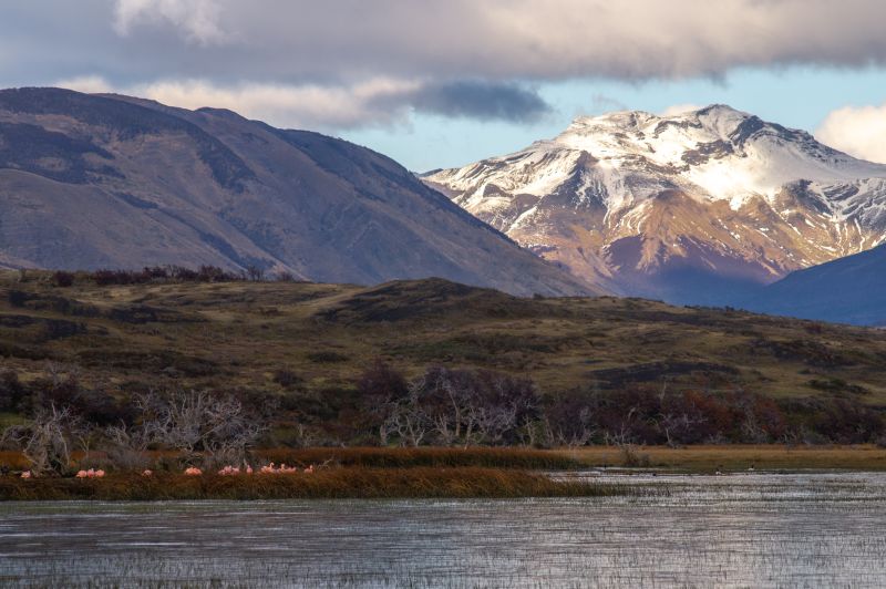
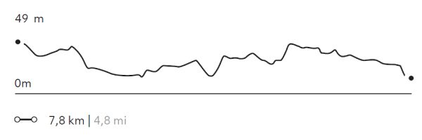
Ideal for lovers of flora and fauna, this exploration takes place outside the park, in the surroundings of a lagoon...
More details >Aves Australes

-
Exploration Path
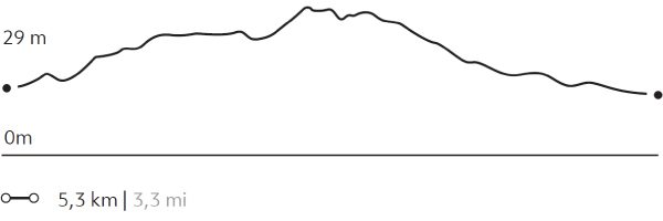
Ideal for lovers of flora and fauna, this exploration takes place outside the park, in the surroundings of a lagoon inhabited by different bird species. We hike while contemplating the varied vegetation and the behavior and sound of the birds. Between September and April, sightings increase due to the favorable conditions offered by spring and summer.
139 m 456 ft
-139 m -456 ft
49 m 161 ft
30 m 98 ftElevation Profile
LAGUNA NEGRA
Encuentro
-
Horseback Ride
-
Easy
-
Half-day
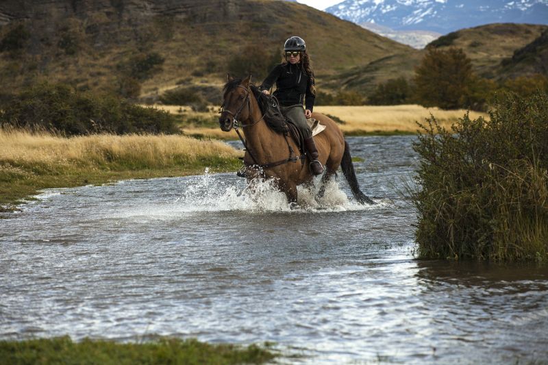
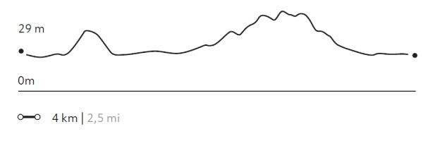
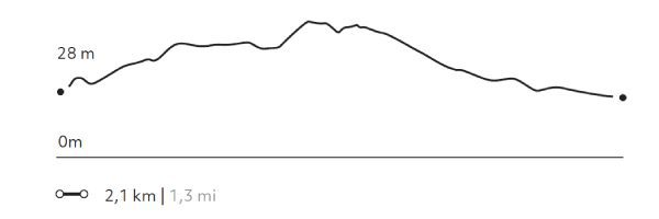
We depart from the stables and ride across rivers, forests and pampas as we ascend towards the viewpoint of the Negra Lagoon...
More details >LAGUNA NEGRA

-
Exploration Path
We depart from the stables and ride across rivers, forests and pampas as we ascend towards the viewpoint of the Negra Lagoon. On the way we pass by several lagoons, ideal for spotting different species of birds such as Queltehues or Magellanic geese.
54 m 177 ft
-54 m -177 ft
53 m 174 ft
28 m 92 ftElevation Profile
CERRO TENERIFE
Montañas
-
High Mountain Ascent
-
Expert
-
Full-day
We travel by van to the base of the Tenerife Hill. We begin our ascent through a forest of ñirres, lengas and coigües, continue among...
More details >CERRO TENERIFE


-
Exploration Path
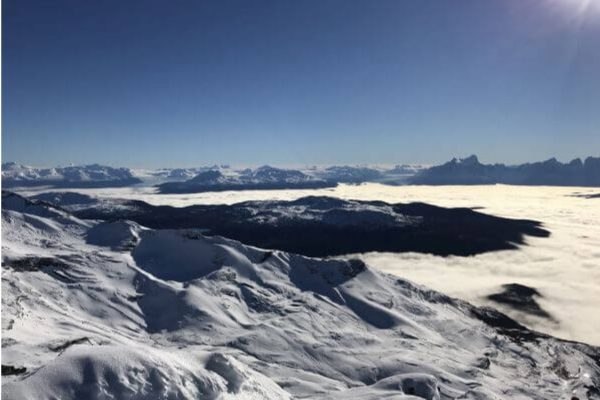
We travel by van to the base of the Tenerife Hill. We begin our ascent through a forest of ñirres, lengas and coigües, continue among humid scrub vegetation and finally through a high desert area. This is a remarkable exploration for the panoramic views it offers: to the Southern Ice Fields and the Chacabuco mountain range, among others.
*Technical equipment and mountain experience required. Subject to weather conditions.
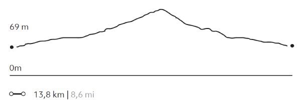
1.582 m 5.190 ft
-1.582 m -5.190 ft
1.564 m 5.131 ft
67 m 220 ftElevation Profile
Cerro Castillo
Montañas
-
High Mountain Ascent
-
Expert
-
Full-day
We travel by van to El Bote Bay, a sector located outside the park. We start our walk in a cattle area and go up the slope of Castillo Hill...
More details >Cerro Castillo
-
Exploration Path
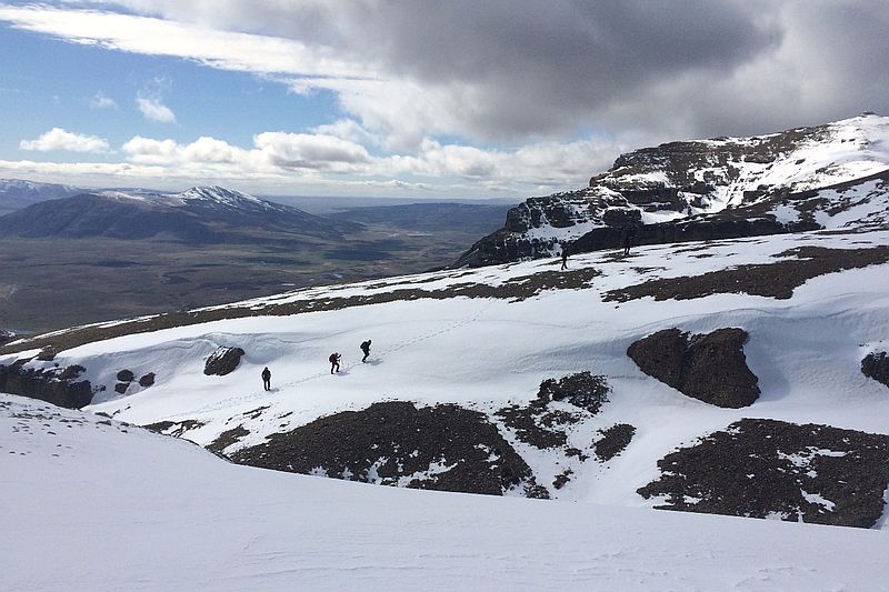
We travel by van to El Bote Bay, a sector located outside the park. We start our walk in a cattle area and go up the slope of Castillo Hill until we reach the summit. From there, we have a 360 ° view of the park and its surroundings. We see hills, glaciers, pampas, lakes and mountains. We descend through a forested area to the van.
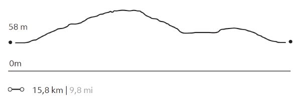
1.170 m 3.839 ft
-1.170 m -3.839 ft
983 m 3.225 ft
57 m 187 ftElevation Profile
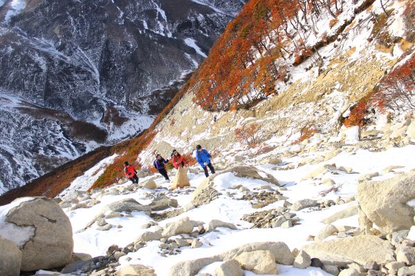
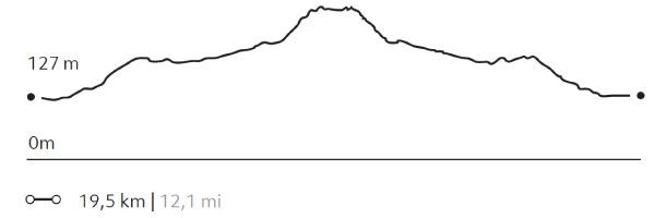
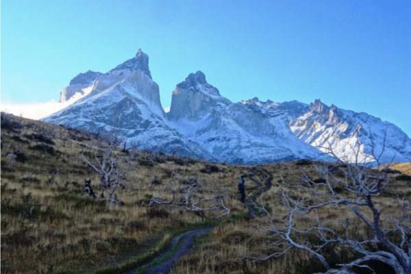
BASE TORRES
Montañas
-
High Mountain Ascent
-
Expert
-
Full-day
This exploration goes through one of the most iconic sectors of the W. We travel by van to the Cerro Paine ranch where we begin...
More details >BASE TORRES
-
Exploration Path
This exploration goes through one of the most iconic sectors of the W. We travel by van to the Cerro Paine ranch where we begin our ascent to the base of the Torres del Paine. At the top, we can appreciate the magnitude of the granite towers and the lagoon at our feet. We return by the same road.
1.153 m 3.783 ft
-1.153 m -3.783 ft
885 m 2.904 ft
123 m 404 ftElevation Profile
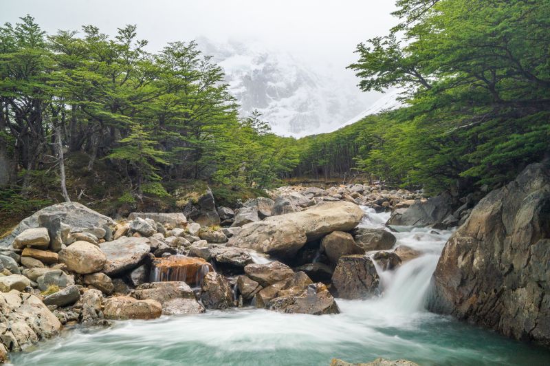
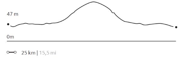
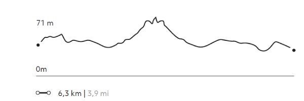
CAMPAMENTO BRITANICO
Glaciar
-
Hike
-
Expert
-
Full-day
This exploration takes us along one section of the W. circuit. We cross Lake Pehoé by catamaran to the Paine Grande shelter, where we will begin our hike to Valle del Francés. We cross lenga forests to the Mirador Británico, a place with 360° views of the natural amphitheater formed by the Horns and imposing rock formations such as the Shark’s Fin and the Fortress.
More details >CAMPAMENTO BRITANICO

-
Exploration Path
This exploration takes us along one section of the W. circuit. We cross Lake Pehoé by catamaran to the Paine Grande shelter, where we will begin our hike to Valle del Francés. We cross lenga forests to the Mirador Británico, a place with 360° views of the natural amphitheater formed by the Horns and imposing rock formations such as the Shark’s Fin and the Fortress.
1.192 m 3.911 ft
-1.192 m -3.911 ft
712 m 2.336 ft
39 m 128 ftElevation Profile
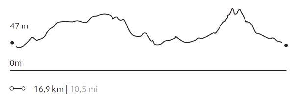
GUARDAS
Glaciar
-
Hike
-
Expert
-
Full-day
We cross Pehoé Lake on a catamaran to the Paine Grande refuge where we begin our trek to the Grey refuge...
More details >GUARDAS
-
Exploration Path
We cross Pehoé Lake on a catamaran to the Paine Grande refuge where we begin our trek to the Grey refuge. From there, we walk towards the viewpoint at Guardas camp with panoramic views of the glacier. We return to the refuge. There we board a boat that will take us to the glacier and then leave us on the other side of Grey Lake. We walk back to the van.
*Browsing is subject to the availability of Explora's external operator.
For safety reasons, this exploration is available only between the months of September and April.
939 m 3.081 ft
-920 m -3.018 ft
306 m 1.004 ft
39 m 128 ftElevation Profile
NORDENSKJÖLD
Encuentro
-
Hike
-
Easy
-
Half-day
We travel by van to Salto Grande and begin our trek with views of the Paine Grande and its hanging glaciers. Then, we reach the turquoise...
More details >NORDENSKJÖLD
-
Exploration Path
We travel by van to Salto Grande and begin our trek with views of the Paine Grande and its hanging glaciers. Then, we reach the turquoise waters of Lake Nordenskjöld, at the foot of the massif where the sound of breaking ice can occasionally be heard. We return to the lodge by van.
139 m 456 ft
-139 m -456 ft
116 m 381 ft
62 m 203 ftElevation Profile
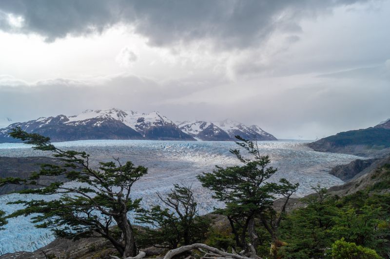
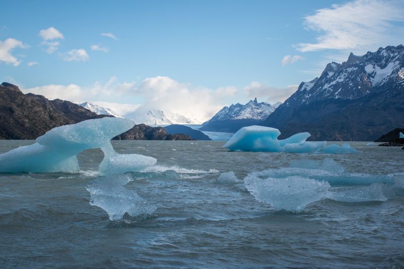
LAGO GREY
Bosque
-
Hike
-
Easy
-
Half-day
We leave by van for the Lake Grey sector. From there we begin our walk by crossing the Pingo River through a forest until reaching the lakeshore. We’ll walk along the beach with views of the Grey glacier and the ice floes that break off of it.
More details >LAGO GREY
-
Exploration Path
We leave by van for the Lake Grey sector. From there we begin our walk by crossing the Pingo River through a forest until reaching the lakeshore. We’ll walk along the beach with views of the Grey glacier and the ice floes that break off of it.
126 m 413 ft
-126 m -413 ft
82 m 269 ft
45 m 148 ftElevation Profile
MIRADOR TORO
Encuentro
-
Hike
-
Easy
-
Half-day
We travel by van to the Weber bridge, from which we walk to Toro Lake. On the way we can observe evidence...
More details >MIRADOR TORO
-
Exploration Path
We travel by van to the Weber bridge, from which we walk to Toro Lake. On the way we can observe evidence of the ice that once covered the park. We ascend to an overlook with panoramic views. On the descent we pass by a lagoon. We return by van.
98 m 322 ft
-98 m -322 ft
83 m 272 ft
25 m 82 ftElevation Profile
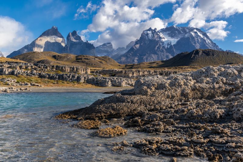
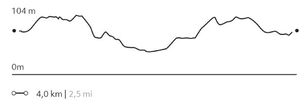
SARMIENTO
Estepa
-
Hike
-
Easy
-
Half-day
We will walk along a trail with low vegetation and views of the Paine Horns and Almirante Nieto. We then go down to the beach on the shores of Lake Sarmiento, where we will have the chance to walk among incredible calcium carbonate rock formations.
More details >SARMIENTO
-
Exploration Path
We will walk along a trail with low vegetation and views of the Paine Horns and Almirante Nieto. We then go down to the beach on the shores of Lake Sarmiento, where we will have the chance to walk among incredible calcium carbonate rock formations.
100 m 328 ft
-100 m -328 ft
125 m 410 ft
80 m 262 ftElevation Profile
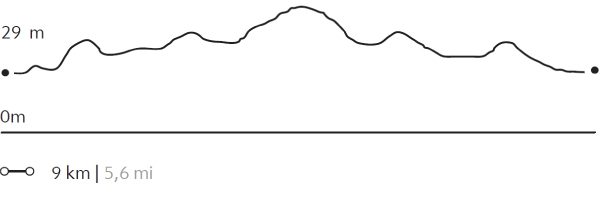
Pingo Chorrillo
Bosque
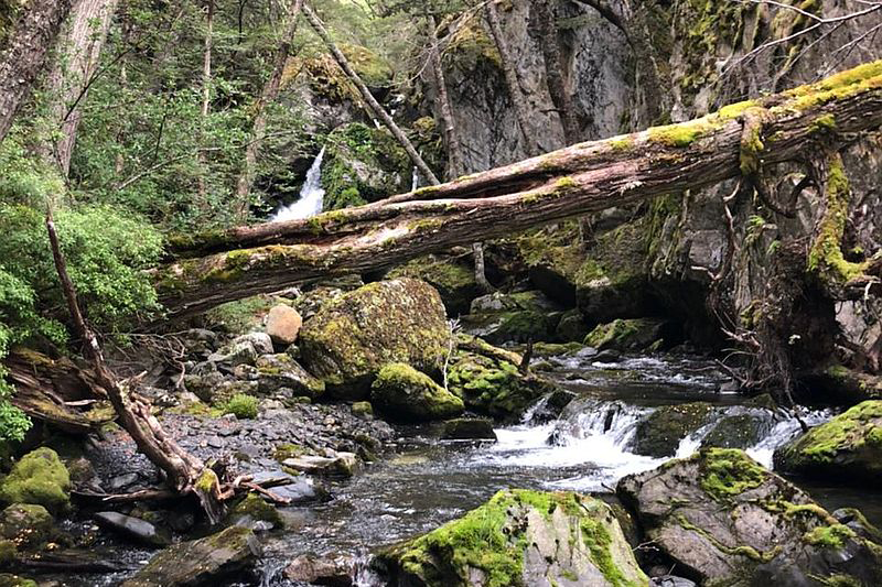
-
Hike
-
Moderate
-
Half-day
We travel by van to Grey Lake. From there, we walk along a path along the Pingo River through a forest of native trees...
More details >Pingo Chorrillo
-
Exploration Path
We travel by van to Grey Lake. From there, we walk along a path along the Pingo River through a forest of native trees. During this exploration, we can enjoy different views of the Paine massif and bird watching. The return is by the same path.
235 m 771 ft
-235 m -771 ft
105 m 344 ft
56 m 184 ftElevation Profile
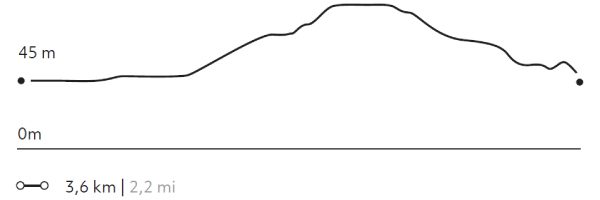
Mirador Condor
Encuentro
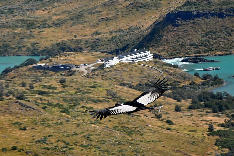
-
Hike
-
Moderate
-
Half-day
We leave the hotel, walking along the shore of Pehoé Lake. In the distance, we see a hill on the summit...
More details >Mirador Condor
-
Exploration Path
We leave the hotel, walking along the shore of Pehoé Lake. In the distance, we see a hill on the summit of which is the Condor lookout, our destination. On the way, we pass through lenga and ñirre forests. When we get to the top, we have a 360° view of the park. We descend down a rocky slope to the van.
253 m 830 ft
-232 m -761 ft
239 m 784 ft
45 m 148 ftElevation Profile
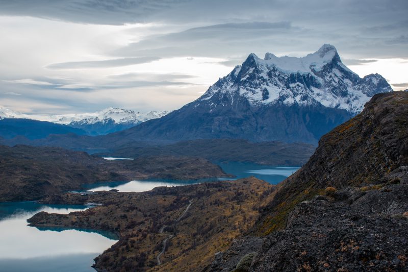
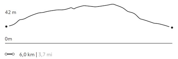
Cornisas
Encuentro
-
Hike
-
Advanced
-
Half-day
We walk towards the Paine River until we reach the cliffs that give name to this exploration. As we gain altitude...
More details >Cornisas

-
Exploration Path
We walk towards the Paine River until we reach the cliffs that give name to this exploration. As we gain altitude, we have panoramic views from different perspectives. We see the Paine River, Pehoé Lake and at the top, we can contemplate the Paine mountain range and the surrounding valleys.
414 m 1358 ft
-427 m -1401 ft
373 m 1.224 ft
28 m 92 ftElevation Profile
-
Other options: