All Explorations
Areas
Activity
Difficulty
-
 At the sea
 -
Advanced
-
Half-day
 At the sea
  Advanced
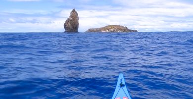
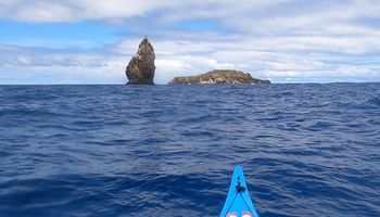
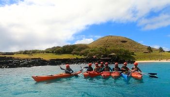
 Paddle along the legendary coastline that gave rise to the Birdman ritual.
VIEW DETAILS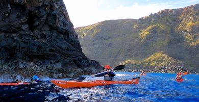
-
At the sea
-
Moderate
-
Half-day
 Moderate
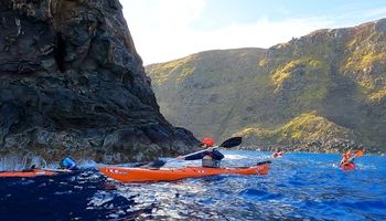
 This kayaking exploration follows one of the most powerful stretches of coastline on Rapa Nui’s eastern shore. Explore Tongariki and the Motu Maratiri.
VIEW DETAILS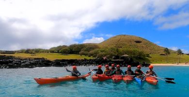
-
At the sea
-
Moderate
-
Half-day
Follow one of the most symbolic stretches of Rapa Nui’s coast. Starting from Anakena, believed to be the landing site of the island’s first Polynesian settlers,
VIEW DETAILS
-
At the sea
-
Easy
-
Half-day
 Easy
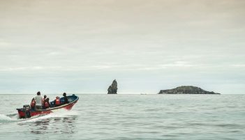
Easy We leave the lodge by van to the fishermen's cove in Hanga Roa. From there we take a boat southwest, flanking the coast to see the caves in the area and then observe the cliffs of Rano Kau and surrounding areas. We then go to Motu Kao Kao, where we will flank the area to observe the transparency of the water and the volcanic formations of the islets. The islets are bird sanctuaries, meaning that where we will be able to observe the largest number of bird species on the island.
VIEW DETAILS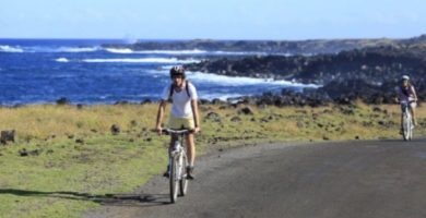
-
Bike
-
Advanced
-
Half-day
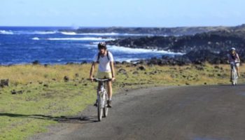
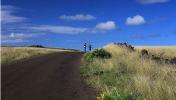
 Bike
Bike We leave by van towards Mahatua, an ancient Rapa Nui settlement. Then we bike ride to the Tea Tea Mountain, in the Poike peninsula...
VIEW DETAILS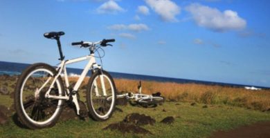
-
Bike
-
Expert
-
Full-day
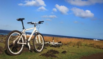
 Expert
 In this exploration we’ll see the contrasting landscapes of Easter Island. We first ride up to the Terevaka...
VIEW DETAILS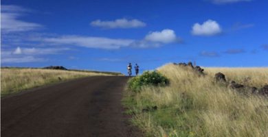
-
Combination
-
Advanced
-
Full-day
 Combination
 We start in Ahu Tahira, a construction platform with perfectly overlapping rock structures...
VIEW DETAILS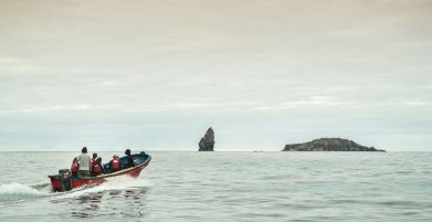
-
At the sea
-
Moderate
-
Half-day
We take a van from the lodge to Hanga Roa’s cove, where we take a boat to sea caves with views to the cliffs...
VIEW DETAILS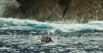
-
At the sea
-
Easy
-
Half-day
Departure by van from the lodge to the Hanga Roa cove, where we take a boat north to the Motu Tautara...
VIEW DETAILS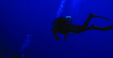
-
At the sea
-
Easy
-
Half-day
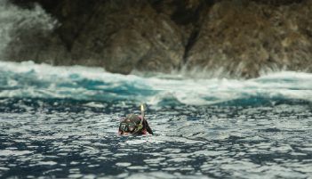
This exploration is the easiest way to get to know Rapa Nui’s amazing submarine world. It includes two stages...
VIEW DETAILS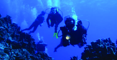
-
At the sea
-
Advanced
-
Half-day
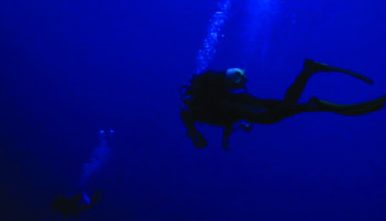
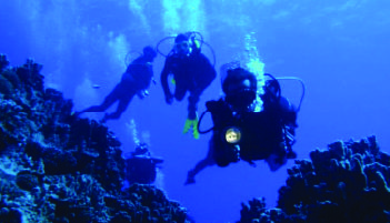
Private diving for travelers with diving certificates, either beginner’s or advanced. This exploration is an invitation to discover...
VIEW DETAILS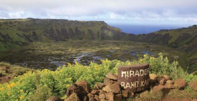
-
Overland
-
Easy
-
Half-day
 Overland
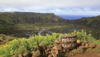
 We depart by van toward Vinapu, visiting its ahu and its unique construction. We then go to Rano Kau, the biggest crater on the island. We hike around part of the crater, where we will see the biodiversity of the wetland inside, before reaching the ceremonial village of Orongo, where we will learn more about the story of the famous Birdman competition.
VIEW DETAILS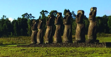
-
Overland
-
Easy
-
Half-day
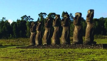
We visit Akivi, with its Ahu and 7 moais facing the sea. We will walk through the Roiho lava field and visit a lava tunnel, the cave Ana Te Pahu. We continue by van to visit the ahu Tahai, an archeological complex with a coral-eyed moai.
VIEW DETAILS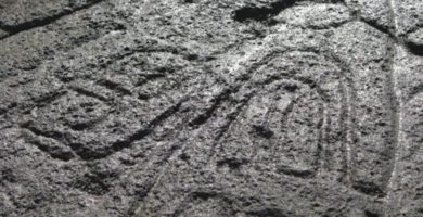
-
Overland
-
Easy
-
Half-day
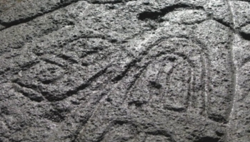
We take a van to Papa Vaka, an archaeological site with petroglyphs. We hike and go by a cove and continue hiking up to Tepito Kura...
VIEW DETAILS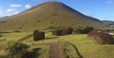
-
Overland
-
Easy
-
Half-day
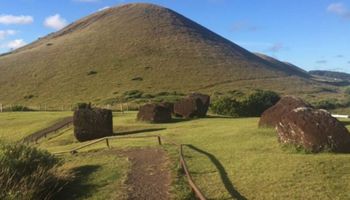
On this exploration we discover the traces of the Pukao (“hair bun” in Rapa Nui) trail to the Moais. We start in Puna Pao, the Pukao quarry, continue toward the Ahu Huri and on to Urenga, a curious platform because of its style and astronomical alignment. After this visit, we take the van to the south coast to visit Hanga Poukura, the largest unrestored platform or Ahu on the island, and Hanga Te'e with its interpretive center, where we will walk to gain more profound knowledge of the history and landscape of one of Rapa Nui’s less explored areas.
VIEW DETAILSDiscover Our Destinations
Endless revelations and possibilities await.