Easter Island
Easter Island, Chile
Explorations in
Easter Island
Activity
Difficulty
Areas
Tangata Manu
Vaikava
-
 At the sea
 -
Advanced
-
Half-day
Tangata Manu


-
Exploration Path
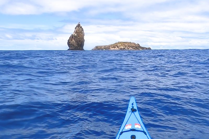
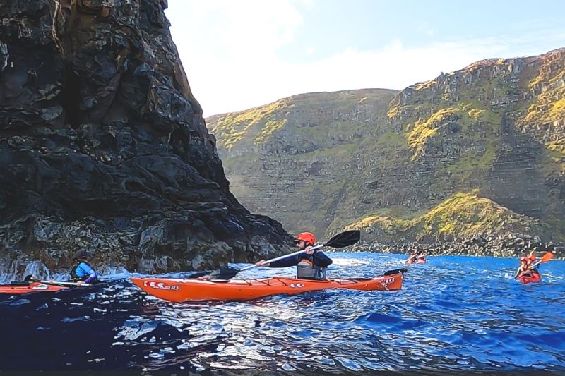
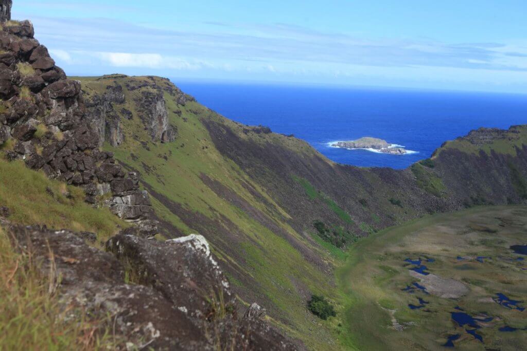
Paddle along the legendary coastline that gave rise to the Birdman ritual. From Hanga Piko, navigate toward the islets of Motu Nui, Motu Iti, and Motu Kao Kao—once the finish line of a daring ocean challenge where competitors swam to retrieve a single egg that would crown a new leader. Surrounded by steep cliffs, seabirds, and the unpredictable Pacific, this journey reveals the dramatic setting of one of Rapa Nui’s most powerful ancestral rites.
Maratiri
Vaikava
-
At the sea
-
Moderate
-
Half-day
This kayaking exploration follows one of the most powerful stretches of coastline on Rapa Nui’s eastern shore. Explore Tongariki and the Motu Maratiri.
More details >Maratiri

-
Exploration Path
This kayaking exploration follows one of the most powerful stretches of coastline on Rapa Nui’s eastern shore. Departing from Hanga Nui, with constant views of Ahu Tongariki, we navigate toward the remote Motu Maratiri along an open bay shaped by wind and ocean. This same coastline was described by Captain Cook during the era when the moai lay fallen, offering a rare historical perspective from the sea. A journey that connects landscape, history, and the calm presence of Rapa Nui’s eastern coast.
Ariki
Vaikava
-
At the sea
-
Moderate
-
Half-day
Follow one of the most symbolic stretches of Rapa Nui’s coast. Starting from Anakena, believed to be the landing site of the island’s first Polynesian settlers,
More details >Ariki
-
Exploration Path
This kayak exploration follows one of the most symbolic stretches of Easter Island's coast. Starting from Anakena, believed to be the landing site of the island’s first Polynesian settlers, we paddle toward Ovahe through calm, clear waters. The route connects two iconic beaches and offers insight into the island’s origins, its connection to the ocean, and ancestral navigation traditions.
Motu Nui
Vaikava
-
At the sea
-
Easy
-
Half-day
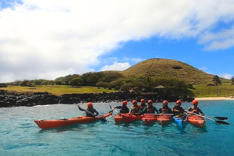
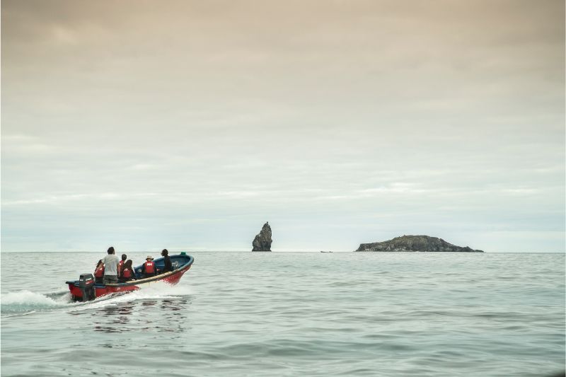
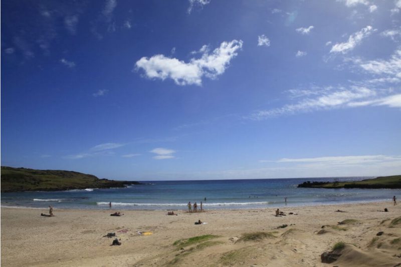
We leave the lodge by van to the fishermen's cove in Hanga Roa. From there we take a boat southwest, flanking the coast to see the caves in the area and then observe the cliffs of Rano Kau and surrounding areas. We then go to Motu Kao Kao, where we will flank the area to observe the transparency of the water and the volcanic formations of the islets. The islets are bird sanctuaries, meaning that where we will be able to observe the largest number of bird species on the island.
More details >Motu Nui

-
Exploration Path
We leave the lodge by van to the fishermen's cove in Hanga Roa. From there we take a boat southwest, flanking the coast to see the caves in the area and then observe the cliffs of Rano Kau and surrounding areas. We then go to Motu Kao Kao, where we will flank the area to observe the transparency of the water and the volcanic formations of the islets. The islets are bird sanctuaries, meaning that where we will be able to observe the largest number of bird species on the island.
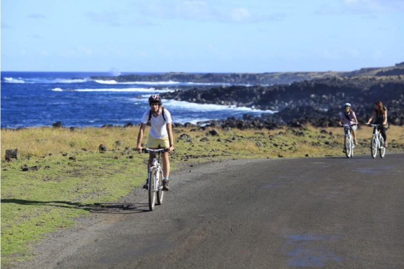
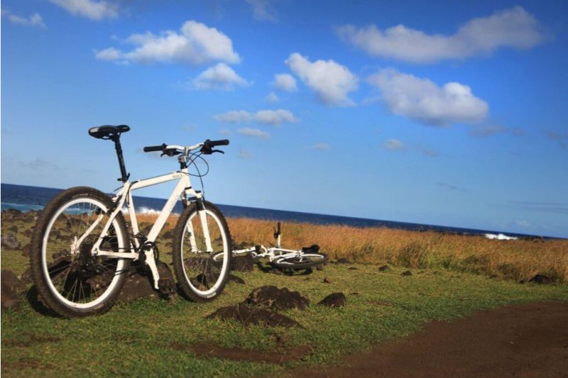
La Peninsula
Ora
-
Bike
-
Advanced
-
Half-day
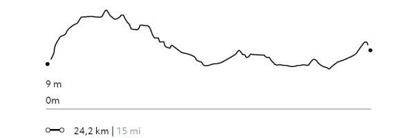
We leave by van towards Mahatua, an ancient Rapa Nui settlement. Then we bike ride to the Tea Tea Mountain, in the Poike peninsula...
More details >La Peninsula

-
Exploration Path
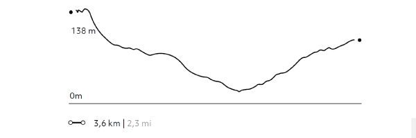
We leave by van towards Mahatua, an ancient Rapa Nui settlement. Then we bike ride to the Tea Tea Mountain, in the Poike peninsula. We then follow along the south coastline cliffs and reach Ahu Tongariki, the Island’s largest platform from where we return taking byways.
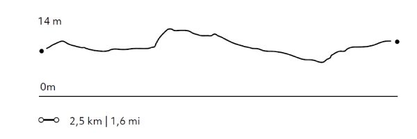
562 m 1844 ft
-476 m -1562 ft
228 m 748 ft
1 m 3 ftElevation Profile
The Hills
Ora
-
Bike
-
Expert
-
Full-day
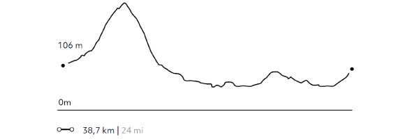
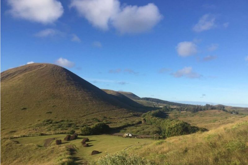
In this exploration we’ll see the contrasting landscapes of Easter Island. We first ride up to the Terevaka...
More details >The Hills

-
Exploration Path
In this exploration we’ll see the contrasting landscapes of Easter Island. We first ride up to the Terevaka, enjoy the view and then ride down to Ahu Akivi. Then, we head to Ahu Tepeu, a site with different archaeological remains. We continue to Hanga Roa and ride along the south coastline enjoying a view to the ocean. We return by bike.
772 m 2533 ft
-770 m -2526 ft
500 m 1640 ft
6 m 20 ftElevation Profile
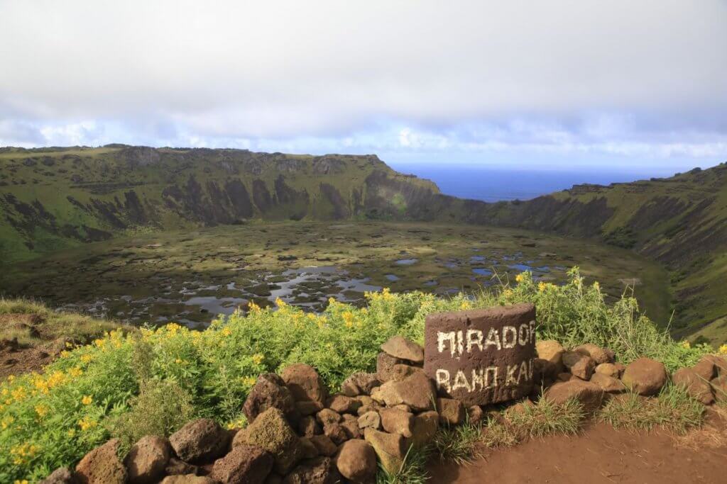
Rano Kau
Ora
-
Combination
-
Advanced
-
Full-day
We start in Ahu Tahira, a construction platform with perfectly overlapping rock structures...
More details >Rano Kau

-
Exploration Path
We start in Ahu Tahira, a construction platform with perfectly overlapping rock structures. We begin hiking to the crater of the Rano Kau Volcano and Orongo. This is the ancient ceremonial village where Birdman competitions used to take place. We head down south by bike and ride along the coast visiting several archaeological sites. We keep on going to Explora.
675 m 2215 ft
-442 m -1450 ft
301 m 988 ft
24 m 79 ftElevation Profile

Snorkeling Bird islets
Vaikava
-
At the sea
-
Moderate
-
Half-day
We take a van from the lodge to Hanga Roa’s cove, where we take a boat to sea caves with views to the cliffs...
More details >Snorkeling Bird islets
-
Exploration Path
We take a van from the lodge to Hanga Roa’s cove, where we take a boat to sea caves with views to the cliffs, the Rano Kau crater and Motus, the famous islets due to the Birdman competition. We can snorkel around the Motus due to unbeatable clear water conditions.
Snorkeling Motu Tautara
Vaikava
-
At the sea
-
Easy
-
Half-day
Departure by van from the lodge to the Hanga Roa cove, where we take a boat north to the Motu Tautara...
More details >Snorkeling Motu Tautara
-
Exploration Path
Departure by van from the lodge to the Hanga Roa cove, where we take a boat north to the Motu Tautara, an islet that is located very close to the island and in front of Ana Kakenga, a cave also known as two windows. During the boat trip you can appreciate a different view of the Tahai complex, as well as other archaeological sites located on the northwest coast of the island. The area where the Motu Tautara is located is part of a protected coastal marine area in which corals and a diversity of marine fauna can be seen, in addition to endemic species.
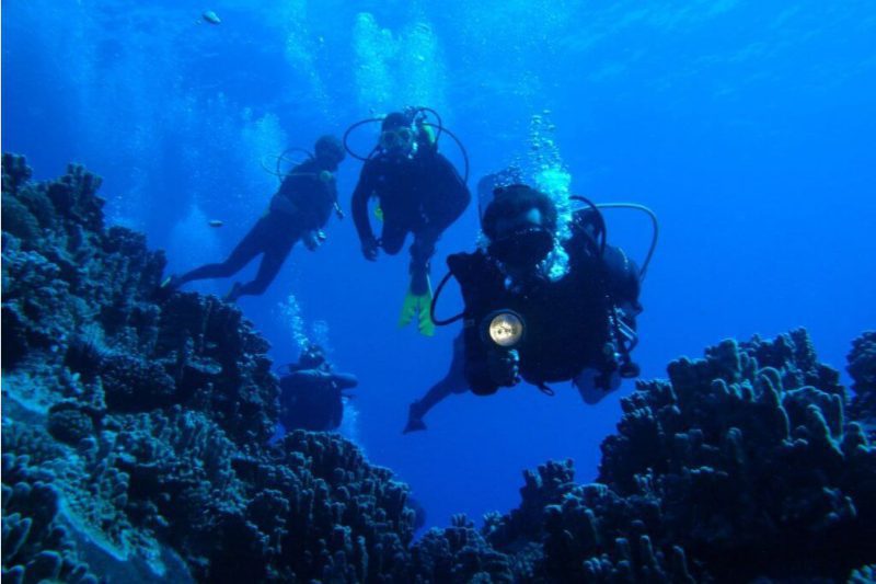
Discover Scuba Diving
Vaikava
-
At the sea
-
Easy
-
Half-day
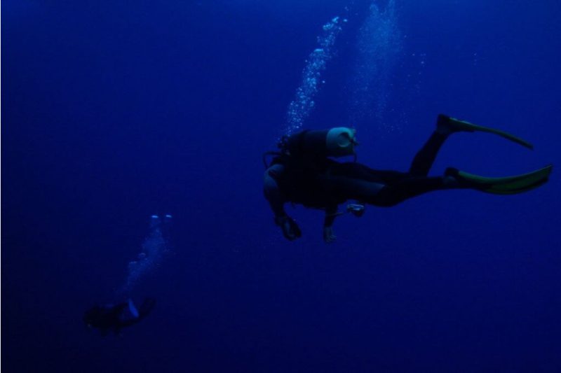
This exploration is the easiest way to get to know Rapa Nui’s amazing submarine world. It includes two stages...
More details >Discover Scuba Diving
-
Exploration Path
This exploration is the easiest way to get to know Rapa Nui’s amazing submarine world. It includes two stages: The first stage where a guide teaches diving theory and conducts a controlled immersion so that guests can get used to the equipment and perform some exercises. The second stage involves a dive in the Hanga Roa bay, experiencing diving in waters known worldwide for their visibility. After completing the diving experience, the traveler gets a discovery or baptism PADI Certificate.
This exploration incurs an additional cost operated by third parties. Subject to climate conditions.
Rapa Nui Diving
Vaikava
-
At the sea
-
Advanced
-
Half-day
Private diving for travelers with diving certificates, either beginner’s or advanced. This exploration is an invitation to discover...
More details >Rapa Nui Diving
-
Exploration Path
Private diving for travelers with diving certificates, either beginner’s or advanced. This exploration is an invitation to discover Easter Island’s underwater world and includes two dives. Some of the places we visit include the sunken moai the Nui and Iti motus, surrounded by corals, and the Cathedral, a complex of submarine caves.
*This exploration incurs an additional cost operated by third parties. Subject to climate conditions.
Bird Cult
Tao a Tupuna
-
Overland
-
Easy
-
Half-day
We depart by van toward Vinapu, visiting its ahu and its unique construction. We then go to Rano Kau, the biggest crater on the island. We hike around part of the crater, where we will see the biodiversity of the wetland inside, before reaching the ceremonial village of Orongo, where we will learn more about the story of the famous Birdman competition.
More details >Bird Cult

-
Exploration Path
We depart by van toward Vinapu, visiting its ahu and its unique construction. We then go to Rano Kau, the biggest crater on the island. We hike around part of the crater, where we will see the biodiversity of the wetland inside, before reaching the ceremonial village of Orongo, where we will learn more about the story of the famous Birdman competition.
159 m 522 ft
-146 m -479 ft
294 m 965 ft
213 m 699 ftElevation Profile
Rapa Nui Sanctuaries
Tao a Tupuna
-
Overland
-
Easy
-
Half-day
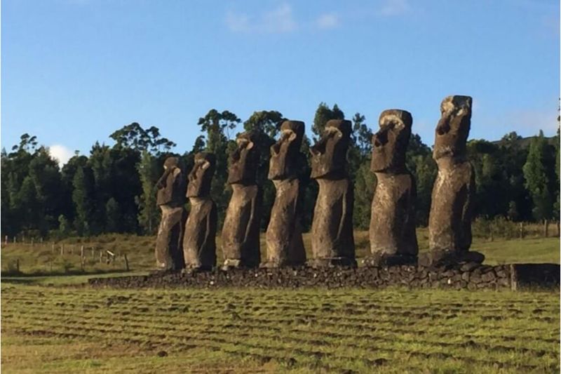
We visit Akivi, with its Ahu and 7 moais facing the sea. We will walk through the Roiho lava field and visit a lava tunnel, the cave Ana Te Pahu. We continue by van to visit the ahu Tahai, an archeological complex with a coral-eyed moai.
More details >Rapa Nui Sanctuaries
-
Exploration Path
We visit Akivi, with its Ahu and 7 moais facing the sea. We will walk through the Roiho lava field and visit a lava tunnel, the cave Ana Te Pahu. We continue by van to visit the ahu Tahai, an archeological complex with a coral-eyed moai.
38 m 123 ft
-56 m -182 ft
138 m 453 ft
89 m 292 ftElevation Profile
Hanga
Tao a Tupuna
-
Overland
-
Easy
-
Half-day
We take a van to Papa Vaka, an archaeological site with petroglyphs. We hike and go by a cove and continue hiking up to Tepito Kura...
More details >Hanga
-
Exploration Path
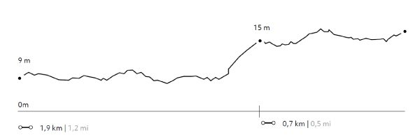
We take a van to Papa Vaka, an archaeological site with petroglyphs. We hike (1) and go by a cove and continue hiking up to Tepito Kura, a site featuring a huge tumbled moai and a magnetic stone associated to Rapa Nui’s origins. We continue by van to Anakena, the landing area of the first Polynesian settlers (2). Time to enjoy the beach. Bring your swimsuit.
34 m 112 ft
-17 m -55 ft
26 m 85 ft
4 m 13 ftElevation Profile
Pukao
Tao a Tupuna
-
Overland
-
Easy
-
Half-day
On this exploration we discover the traces of the Pukao (“hair bun” in Rapa Nui) trail to the Moais. We start in Puna Pao, the Pukao quarry, continue toward the Ahu Huri and on to Urenga, a curious platform because of its style and astronomical alignment. After this visit, we take the van to the south coast to visit Hanga Poukura, the largest unrestored platform or Ahu on the island, and Hanga Te'e with its interpretive center, where we will walk to gain more profound knowledge of the history and landscape of one of Rapa Nui’s less explored areas.
More details >Pukao
-
Exploration Path
On this exploration we discover the traces of the Pukao (“hair bun” in Rapa Nui) trail to the Moais. We start in Puna Pao, the Pukao quarry, continue toward the Ahu Huri and on to Urenga, a curious platform because of its style and astronomical alignment. After this visit, we take the van to the south coast to visit Hanga Poukura, the largest unrestored platform or Ahu on the island, and Hanga Te'e with its interpretive center, where we will walk to gain more profound knowledge of the history and landscape of one of Rapa Nui’s less explored areas.
23 m 75 ft
-25 m -83 ft
16 m 52 ft
3 m 10 ftElevation Profile
-
Other options: