Sacred Valley
Sacred Valley of the Incas, Peru
Explorations in
Sacred Valley
Activity
Difficulty
Areas
Rio Urubamba
Quechua
-
 Bike
Bike -
Easy
-
Half-day
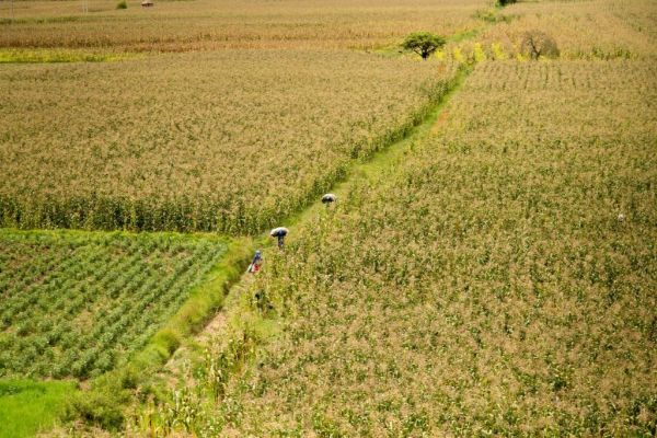
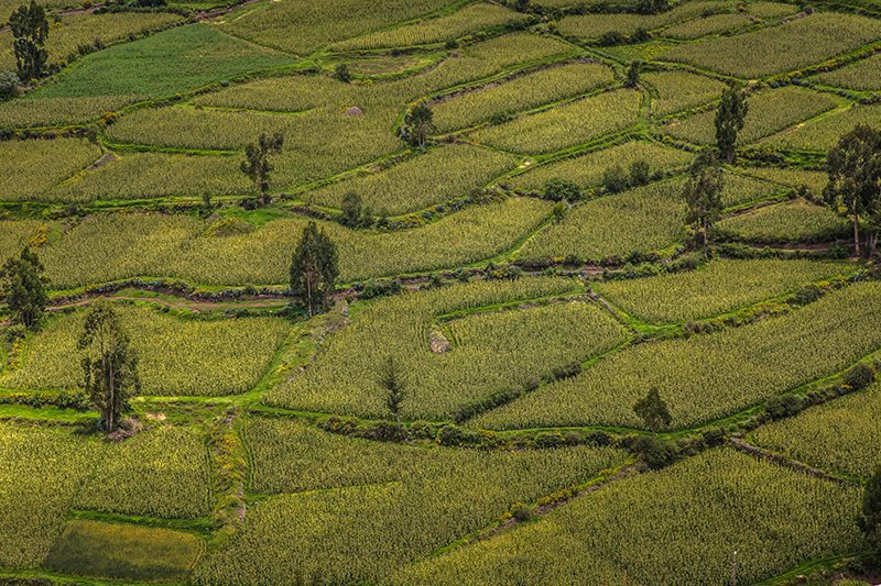
The road used for this exploration goes down the south side of the Urubamba River, a quiet area of cornfields, old haciendas and manors from...
More details >Rio Urubamba


-
Exploration Path
The road used for this exploration goes down the south side of the Urubamba River, a quiet area of cornfields, old haciendas and manors from the 19th and 20th centuries. This bike ride is recommended for families wishing to take a long walk or for those who want to take on a sport.
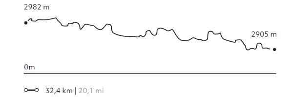
858 m 2.815 ft
-928 m -3.045 ft
2.996 m 9.829 ft
2.811 m 9.222 ftElevation Profile
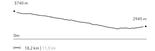
Cuesta del Sapo
Quechua
-
Bike
-
Moderate
-
Half-day
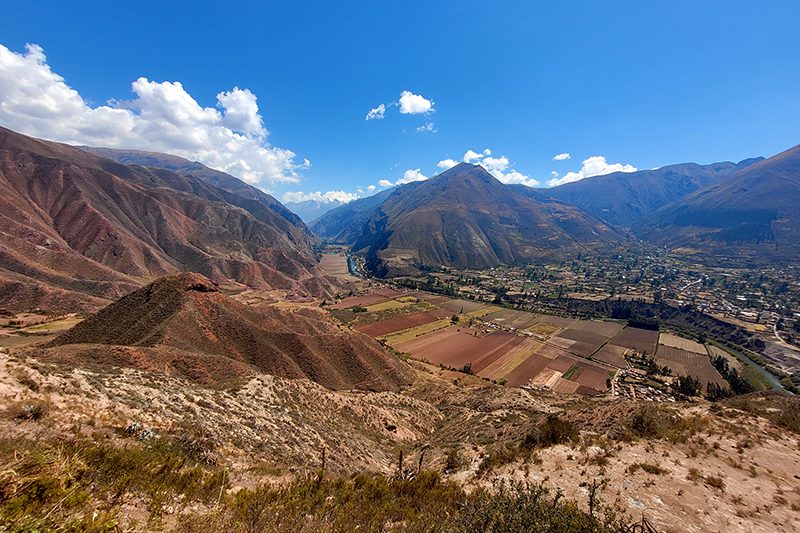
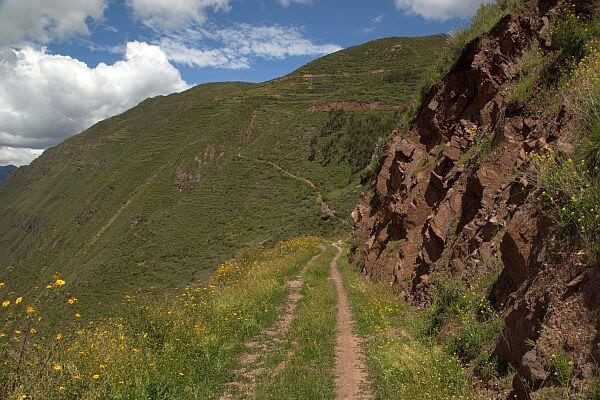
From the heights of the Sacred Valley’s slopes we descend over a track in good conditions. The road offers very interesting views to the mountains...
More details >Cuesta del Sapo

-
Exploration Path
From the heights of the Sacred Valley’s slopes we descend over a track in good conditions. The road offers very interesting views to the mountains and the Urubamba river. Once downhill, we will continue bordering the river through an area of cornfields and orchards and densely packed Inca terraces.
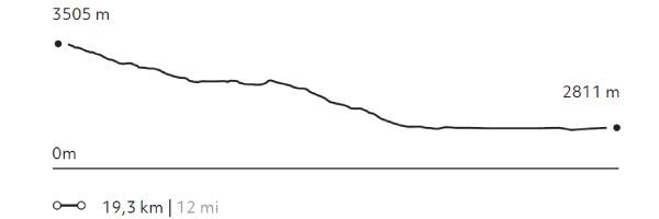
163 m 535 ft
-858 m -2.815 ft
3.505 m 11.499 ft
2.811 m 9.222 ftElevation Profile
Huayna Kolka
Suni
-
Bike
-
Moderate
-
Half-day
After visiting the archaeological site of Machu Kolka, we get on our bikes and begin a descent among trees and adobe houses towards...
More details >Huayna Kolka
-
Exploration Path
After visiting the archaeological site of Machu Kolka, we get on our bikes and begin a descent among trees and adobe houses towards the town of Racchi. There, we pedal in ascent towards the viewpoint of Huayna Kolka to contemplate the valley. We descend by a winding dirt road to Huayllabamba. At this point, we skirt around different crop fields until we reach explora.
403 m 1.322 ft
-1.198 m -3.930 ft
3.740 m 12.270 ft
2.867 m 9.406 ftElevation Profile
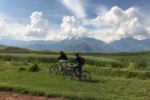
Huaypo Views
Suni
-
Bike
-
Advanced
-
Full-day
This exploration crosses the farmlands of Chinchero, visiting small farms and villages. It takes the traveler...
More details >Huaypo Views

-
Exploration Path
This exploration crosses small farms and villages of Chinchero. It takes the traveler to the remains of the Moray experimental crop center, the colonial town of Maras and its Inca salt-mines, to finalize with a descent to the Urubamba River. This exploration is recommended for travelers in good physical conditions and experienced in mountain biking.
735 m 2.411 ft
-1.557 m -5.108 ft
3.710 m 12.172 ft
2.841 m 9.321 ftElevation Profile
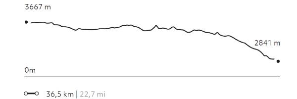
Qenqo
Puna
-
Bike
-
Expert
-
Full-day
The exploration begins in the heights of the pampas and then descends – over a vehicle road – among Quechua communities and farmlands...
More details >Qenqo

-
Exploration Path
The exploration begins in the heights of the pampas and then descends – over a vehicle road – among Quechua communities and farmlands with views to the Sacred Valley and Pisac. In the afternoon, the ride goes follows the south side of the Urubamba river among cornfields, old haciendas and manors from the 19th and 20th century.
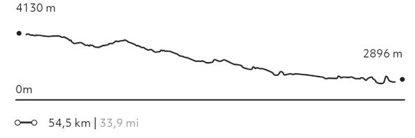
997 m 3.271 ft
-2.209 m -7.247 ft
4.130 m 13.550 ft
2.811 m 9.222 ftElevation Profile
-
Other options: