Easter Island
Easter Island, Chile
Explorations in
Easter Island
Activity
Difficulty
Areas
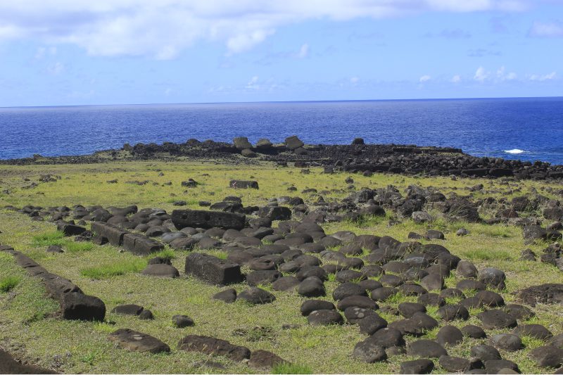
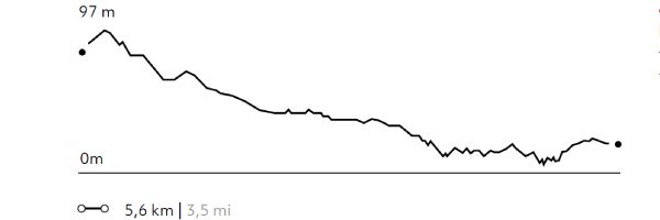
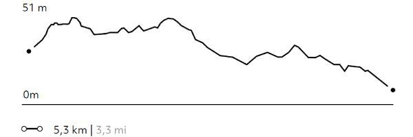
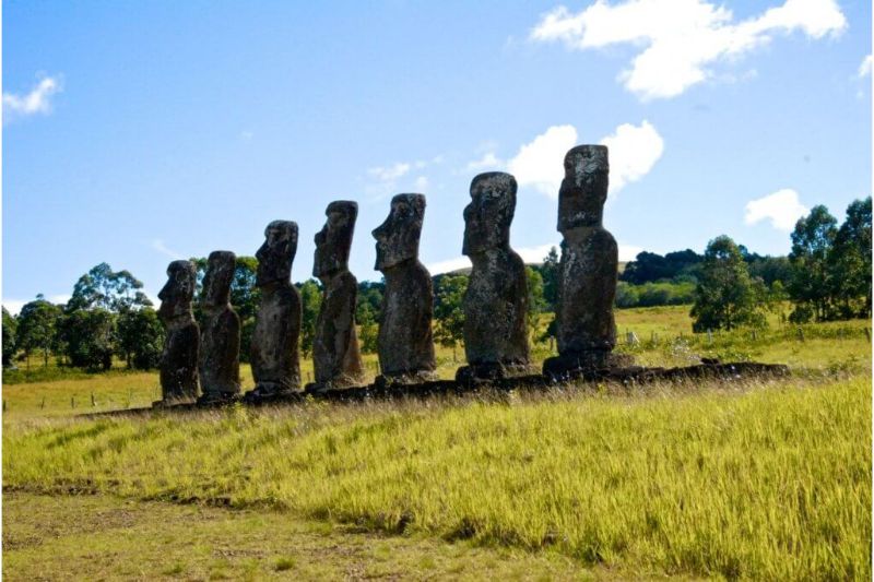
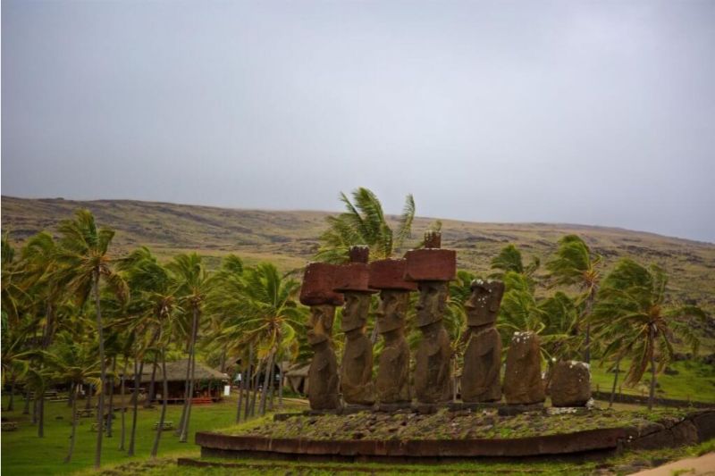
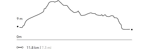
Akahanga
Tao a Tupuna
-
 Hike
Hike -
Easy
-
Half-day
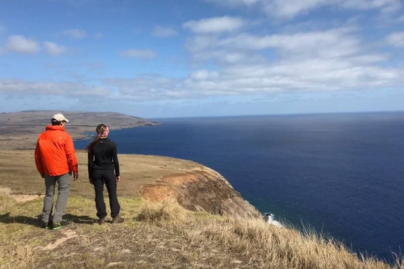
We walk from the lodge to the coastline, descending among prairies, farmlands and archaeological sites...
More details >Akahanga


-
Exploration Path
We walk from the lodge to the coastline, descending among prairies, farmlands and archaeological sites. We finish this hike in the area of Akahanga, where the second largest moai platform is found. We return to the hotel by van.
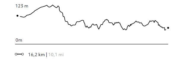
57 m 188 ft
-134 m -440 ft
100 m 328 ft
5 m 16 ftElevation Profile
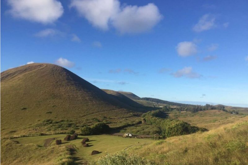
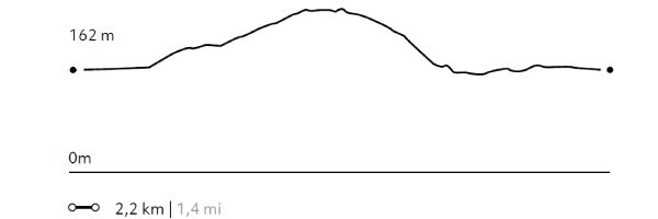
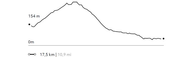
Puna Pau
Tao a Tupuna
-
Hike
-
Easy
-
Half-day
We take a van from the lodge to Maunga Tanga Roa, (the hill with the three crosses) and walk uphill....
More details >Puna Pau
-
Exploration Path
We take a van from the lodge to Maunga Tanga Roa, (the hill with the three crosses) and walk uphill. At the summit, we enjoy a 360° view of the Island. When walking down, we visit the Pukao quarry, red scoria hat-like structures that were formerly placed on top of the moai.
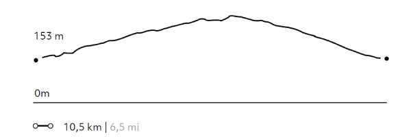
119 m 390 ft
-122 m -400 ft
249 m 817 ft
154 m 505 ftElevation Profile
Ara Moai
Tao a Tupuna
-
Hike
-
Easy
-
Half-day
We start our hike in Rano Raraku, the moai quarry, among huge statues in different carving stages...
More details >Ara Moai
-
Exploration Path
We start our hike in Rano Raraku, the moai quarry, among huge statues in different carving stages. We continue hiking through one of the old moai transportation routes.
114 m 374 ft
-178 m -584 ft
85 m 279 ft
17 m 56 ftElevation Profile
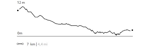
Mahatua
Maohi
-
Hike
-
Moderate
-
Half-day
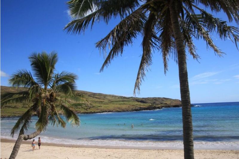
Hike along the coast. We pass fishing coves, archaeological sites and Ovahe beach until we get to Anakena.
More details >Mahatua

-
Exploration Path
Hike along the coast. We pass fishing coves, archaeological sites and Ovahe beach until we get to Anakena where we can visit the archaeological remains of the Rapa Nui kings who lived there. It’s time to enjoy the beach. Bring your swimsuit.
117 m 384 ft
-120 m -394 ft
31 m 102 ft
5 m 16 ftElevation Profile
Roiho
Lava Flows
-
Hike
-
Moderate
-
Half-day
Roiho
-
Exploration Path
Departure by van to Ahu Akivi, the only platform with moai looking out to the sea. Then we walk through the Roiho lava fields with their tunnels and caves. Finally, we continue walking along the coast to Hanga Kioe Bay. We return to Explora by van.
98 m 321 ft
-199 m -653 ft
145 m 476 ft
11 m 36 ftElevation Profile
Pui
Hotu Iti
-
Hike
-
Advanced
-
Half-day
We begin hiking at the foothill of Pui Hill, known by an ancient competition in which Rapa Nui men slid on banana tree barks...
More details >Pui

-
Exploration Path
We begin hiking at the foothill of Pui Hill, known by an ancient competition in which Rapa Nui men slid on banana tree barks. We continue through plains and former moai transportation routes, going by archaeological sites until reaching Rano Raraku, the moai quarry.
43 m 142 ft
-200 m -656 ft
221 m 725 ft
47 m 154 ftElevation Profile
The Bird Man
Ora
-
Hike
-
Advanced
-
Half-day
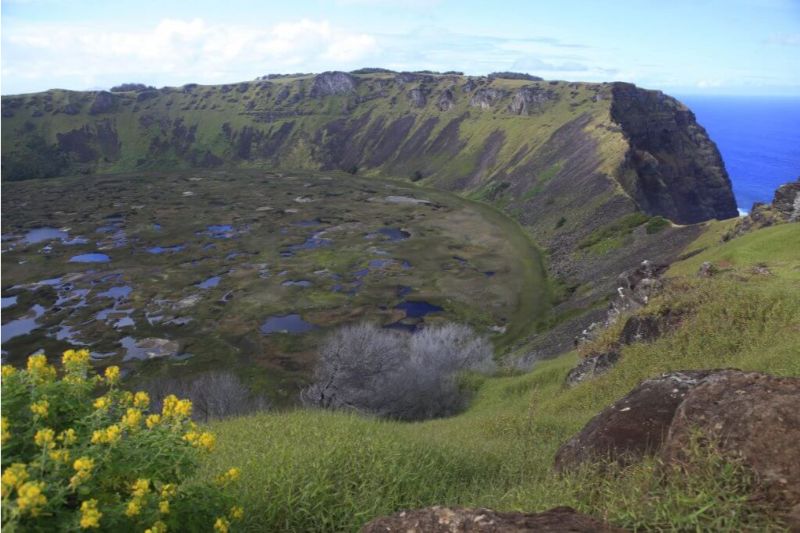
We start in Ahu Tahira, a construction platform with perfectly overlapping stone structures...
More details >The Bird Man
-
Exploration Path
We start in Ahu Tahira, a construction platform with perfectly overlapping stone structures. We go up to the rim of the Rano Kau crater, the largest in the Island and then we hike to Orongo, an ancient ceremonial village where the Birdman competition took place.
675 m 2215 ft
-442 m -1450 ft
301 m 988 ft
24 m 79 ftElevation Profile
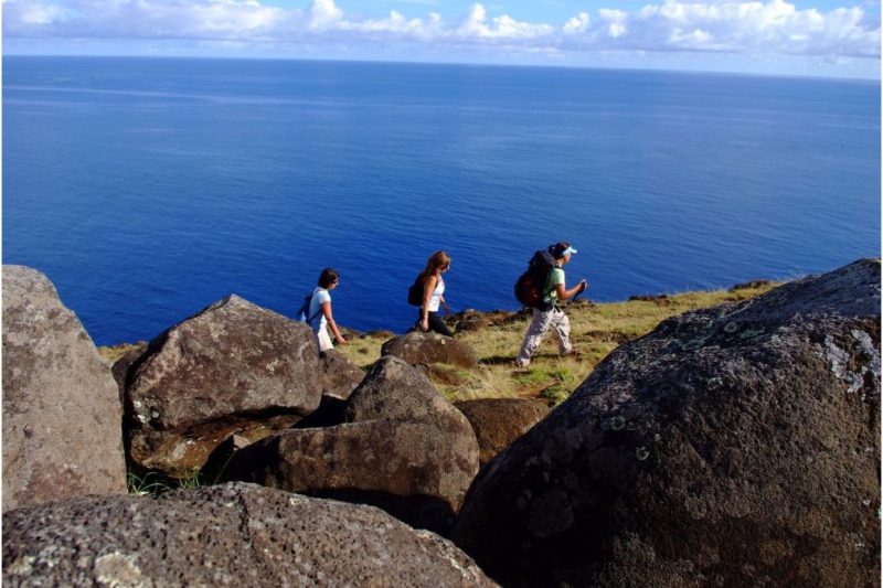
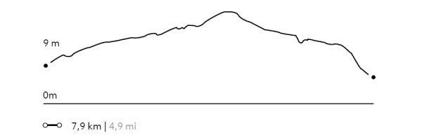
Puakatiki
Ora
-
Hike
-
Moderate
-
Half-day
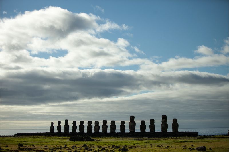
We head to Ahu Mahatua in the Poike peninsula. We follow a trail along a cliff, going by Parehe and Tea-Tea Hills...
More details >Puakatiki
-
Exploration Path
We head to Ahu Mahatua in the Poike peninsula. We follow a trail along a cliff, going by Parehe and Tea-Tea Hills. We continue up to the summit of Puakatiki Hill, which offers a panoramic view of Rapa Nui’s isolated position. We descend following a steep path up to Tongariki, the Ahu of the 15 moai.
410 m 1345 ft
-414 m -1358 ft
361 m 1184 ft
5 m 16 ftElevation Profile
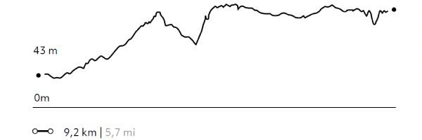
The Miru
Tao a Tupuna
-
Hike
-
Advanced
-
Full-day
We follow a trail along cliffs in the north area, crossing plains and ancient villages that belonged to the Miru...
More details >The Miru
-
Exploration Path
We follow a trail along cliffs in the north area, crossing plains and ancient villages that belonged to the Miru, which used to be the most powerful tribe in Rapa Nui. We continue hiking up to Anakena, this tribe’s capital city, where we get some time to enjoy the beach. Bring your swimsuit.
439 m 1440 ft
-539 m -1768 ft
199 m 653 ft
8 m 26 ftElevation Profile
The highest point
Ora
-
Hike
-
Moderate
-
Half-day
We begin our hike at the foothill of the Terevaka Volcano, going up a narrow creek and passing between archaeological vestiges...
More details >The highest point
-
Exploration Path
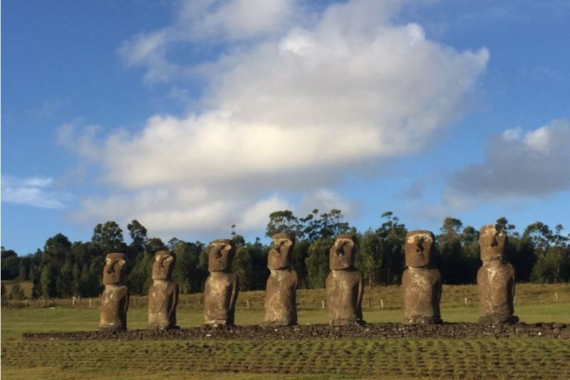
We begin our hike at the foothill of the Terevaka Volcano, going up a narrow creek and passing between archaeological vestiges until we reach the volcano’s summit, the highest point in the Island with 360° views to the horizon. When descending, we hike towards Ahu Akivi, the 7 moai facing the sea.
375 m 1230 ft
-389 m -1276 ft
500 m 1640 ft
138 m 453 ftElevation Profile
Poike
Ora
-
Hike
-
Moderate
-
Full-day
We begin this hike in Mahatua, in the Poike peninsula. We hike up a cliff to trachyte or white rock domes...
More details >Poike
-
Exploration Path
We begin this hike in Mahatua, in the Poike peninsula. We hike up a cliff to trachyte or white rock domes. We visit the hills in this area, hike along the coastline and pass sites with archaeological remains, including the only trachyte moai. We continue walking up to Tongariki, the location of 15 moai. Return to the hotel by van.
496 m 1627 ft
-491 m -1611 ft
263 m 863 ft
5 m 16 ftElevation Profile
Lava flows
Ora
-
Hike
-
Advanced
-
Full-day
In this exploration we hike along cliffs with a view to the ocean, pass an ancient Rapa Nui settlement and see caves shaped by lava flows.
More details >Lava flows
-
Exploration Path
In this exploration we hike along cliffs with a view to the ocean, pass an ancient Rapa Nui settlement and see caves shaped by lava flows. We beging hiking at the foothill of the Terevaka Volcano to reach the highest point in the Island. At the end, we ride a van to the Tahai archaelogical complex.
464 m 1522 ft
-599 m -1965 ft
500 m 1640 ft
15 m 49 ftElevation Profile
-
Other options: