Atacama
Desert & Altiplano, Chile
Explorations in
Atacama
Activity
Difficulty
Areas
Selenita
Cuenca del salar
-
 Horseback Ride
 -
Easy
-
Half-day
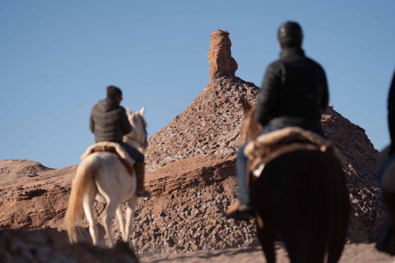
Ride through salt and gypsum formations in the Atacama Desert. Explore Vallecito near Moon Valley on horseback for a one-of-a-kind desert adventure.
More details >Selenita


-
Exploration Path
After a 45-minute drive to the Salt Mountain Range, we begin our horseback ride in a sector known as Vallecito, near the Moon Valley. We ride through formations of salt and gypsum, where the ground crunches beneath the hooves and the landscape reveals the unique geology of this mineral range. We return to the hotel by van at the end of the ride.
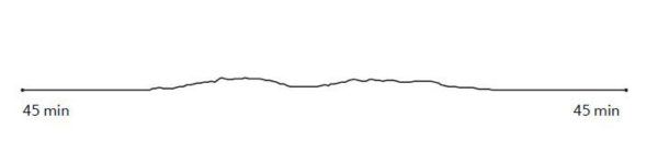
64 m 210 ft
-64 m -210 ft
2474 m 8117 ft
2440 m 8005 ftElevation Profile
Caspana
Altiplano
-
E-Bike
-
Advanced
-
Full-day
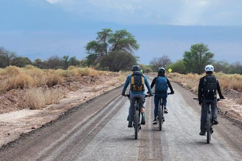
The E-Bike Caspana exploration traverses the striking contrasts of the Altiplano through ancient caravan routes connecting the Tocorpuri plains with Caspana and the Alto Loa region.
More details >Caspana


-
Exploration Path
The E-Bike Caspana exploration follows the ancient caravan routes that connected the Tocorpuri plains with Caspana and the Alto Loa region, as cyclists traverse striking contrasts of the Altiplano: towering volcanoes, arid and seasonal waterways.
342 m 1.122 ft
-1.420 m -4.659 ft
4.484 m 14.711 ft
3.248 m 10.656 ftElevation Profile
Vilama
Cuenca del salar

-
E-Bike
-
Expert
-
Half-day
This exploration leads to the Vilama Pukara viewpoint, where you'll uncover the remains of a Likan Antay fortress, once vital for safeguarding fertile lands and the river delta of the Vilama River
More details >Vilama

-
Exploration Path
This exploration leads to the Vilama Pukara viewpoint, where you'll uncover the remains of a Likan Antay fortress, once vital for safeguarding fertile lands and the river delta of the Vilama River—offering a glimpse into the region’s ancient defensive strategies.
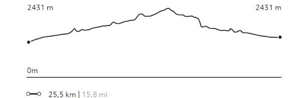
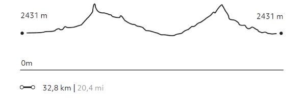
822 m 2.697 ft
-822 m -2.697 ft
2.727 m 8.947 ft
2.430 m 7.972 ftElevation Profile
Oasis
Cuenca del salar
-
E-Bike
-
Easy
-
Half-day
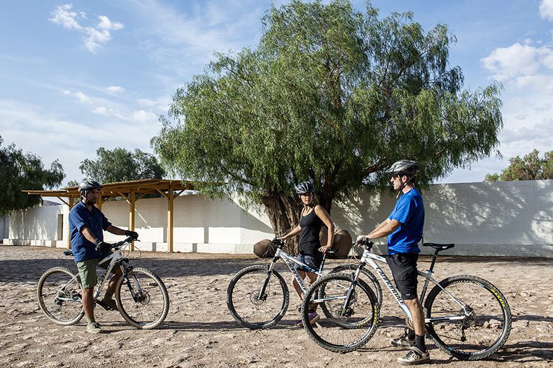
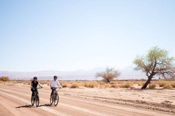
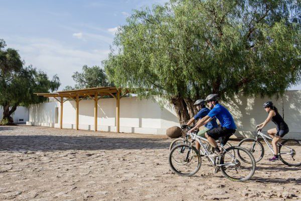
The Oasis E-bike exploration uncovers the ancient settlements of the Licanantay culture in the Atacama Desert.
More details >Oasis
-
Exploration Path
The Oasis E-bike exploration uncovers the ancient settlements of the Licanantay culture in the Atacama Desert. Discover sites like the Tulor settlement in the Ayllu de Coyo, the Puribeter Elemental Reserve, and the Desert Library, blending history, nature, and local culture.
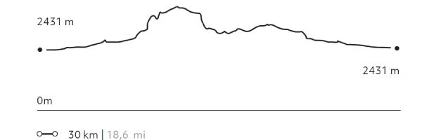
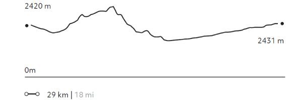
146 m 479 ft
-145 m -476 ft
2431 m 7976 ft
2376 m 7795 ftElevation Profile
Camino del agua
Cuenca del salar
-
Hike
-
Easy
-
Half-day
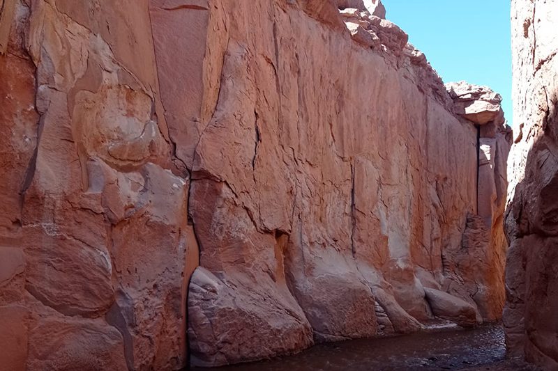
We will travel into the interior of the desert where nature and history blend. We will walk inside an incredible and gigantic canyon, an arm eroded by the water of the San Pedro River that flows within it. We will arrive at a sector with a great quantity of petroglyphs, as the place was a refuge for caravans. For most of the hike, we will be walking through water. *It is recommended to bring two pairs of shoes.
More details >Camino del agua

-
Exploration Path
We will travel into the interior of the desert where nature and history blend. We will walk inside an incredible and gigantic canyon, an arm eroded by the water of the San Pedro River that flows within it. We will arrive at a sector with a great quantity of petroglyphs, as the place was a refuge for caravans. For most of the hike, we will be walking through water.
*It is recommended to bring two pairs of shoes.
Quebrada de Chulacao
Cuenca del salar
-
Hike
-
Easy
-
Half-day
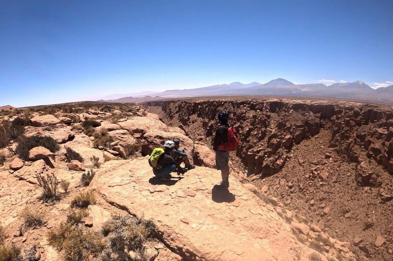
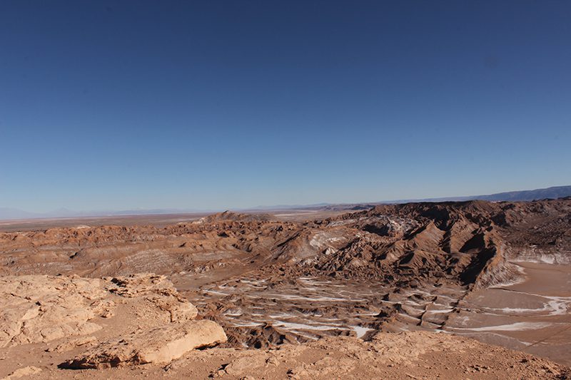
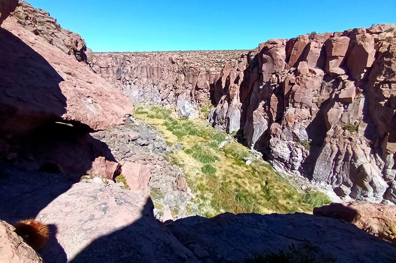
At the foot of the Salt mountains, we come to the Catarpe Valley, which receives the San Pedro river that feeds the oasis and the salt marsh. In the valley, we will begin our hike in the Quebrada Chulaco, a great canyon with high walls, with curves and serpentine shapes formed by moldable minerals and water erosion. Upon leaving the canyon we will hike up to a viewpoint with 360° views of the desert and its mountain ranges. We return along the same trail.
More details >Quebrada de Chulacao
-
Exploration Path
At the foot of the Salt mountains, we come to the Catarpe Valley, which receives the San Pedro river that feeds the oasis and the salt marsh. In the valley, we will begin our hike in the Quebrada Chulaco, a great canyon with high walls, with curves and serpentine shapes formed by moldable minerals and water erosion. Upon leaving the canyon we will hike up to a viewpoint with 360° views of the desert and its mountain ranges. We return along the same trail.
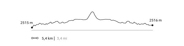
156 m 512 ft
-156 m -512 ft
2.582 m 8.471 ft
2.515 m 8.251 ftElevation Profile
Ronque
Quebradas Intermedias
-
Hike
-
Moderate
-
Full-day
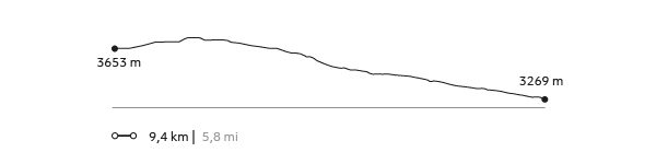
The hike begins in the upper part of Quebrada Jorquencal, a sector with large cacti and archaeological ruins. From there we descend to the Puritama hot springs. We will enjoy lunch there, before continuing our hike along the Puritama River, in a beautiful canyon of native vegetation home to dozens of birds. Our hike ends in the town of Guatín, where the Puritama and Purifica Rivers converge and give life to the Vilama River.
More details >Ronque

-
Exploration Path
The hike begins in the upper part of Quebrada Jorquencal, a sector with large cacti and archaeological ruins. From there we descend to the Puritama hot springs. We will enjoy lunch there, before continuing our hike along the Puritama River, in a beautiful canyon of native vegetation home to dozens of birds. Our hike ends in the town of Guatín, where the Puritama and Purifica Rivers converge and give life to the Vilama River.
161 m 528 ft
-545 m -1788 ft
3732 m 12241 ft
3269 m 10722 ftElevation Profile
Domeyko
Quebradas Intermedias
-
Hike
-
Moderate
-
Half-day
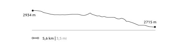
This hike takes place in the Domeyko range, amid great canyons and colors created by the different minerals that make up this mountain range. After getting lost among huge clay walls, we will descend some challenging steps product of the erosion caused by ancient seasonal rivers, and where we will have to use our hands. *Exploration not recommended for people with vertigo or fear of heights.
More details >Domeyko
-
Exploration Path
This hike takes place in the Domeyko range, amid great canyons and colors created by the different minerals that make up this mountain range. After getting lost among huge clay walls, we will descend some challenging steps product of the erosion caused by ancient seasonal rivers, and where we will have to use our hands.
*Exploration not recommended for people with vertigo or fear of heights.
73 m 240 ft
-292 m -958 ft
2.934 m 9.626 ft
2.715 m 8.907 ftElevation Profile
Tambores
Quebradas Intermedias
-
Hike
-
Easy
-
Half-day
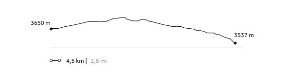
This hike explores the center of the Puritama Conservation Reserve, an area characterized by its great variety of cacti. Along the way we will have a view of the beautiful Quebrada Jorquenal from above, a canyon full of contrasts, vegetation, life and archaeological remains. We descend along a rocky terrain until reaching the Puritama hot springs.
More details >Tambores
-
Exploration Path
This hike explores the center of the Puritama Conservation Reserve, an area characterized by its great variety of cacti. Along the way we will have a view of the beautiful Quebrada Jorquenal from above, a canyon full of contrasts, vegetation, life and archaeological remains. We descend along a rocky terrain until reaching the Puritama hot springs.
118 m 387 ft
-233 m -764 ft
3732 m 12241 ft
3537 m 11601 ftElevation Profile
Caravaneros
Cuenca del salar
-
Hike
-
Easy
-
Half-day
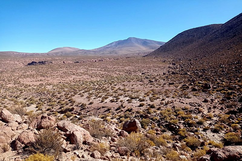
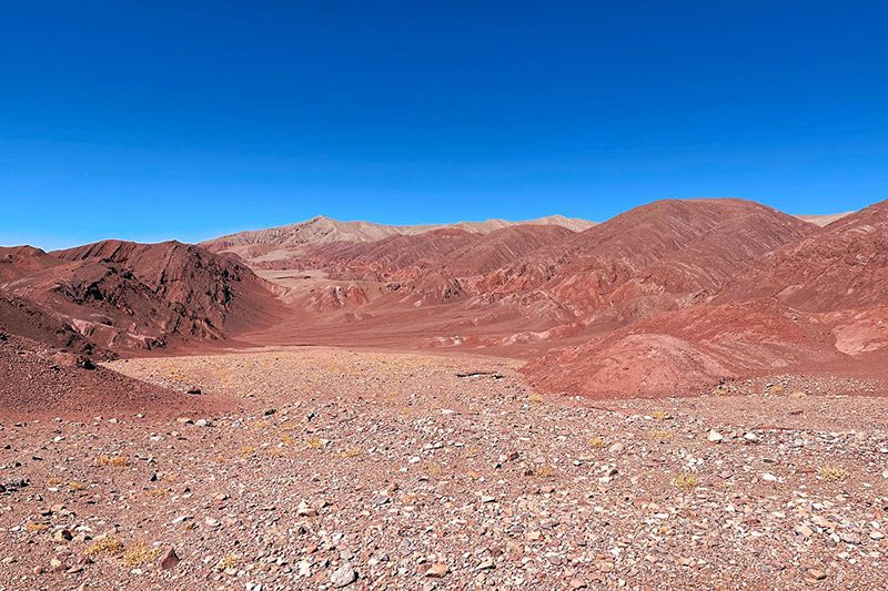
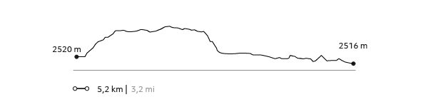
This hike is a journey through the history of the old caravans and their interaction with the desert. We will cross from the Vilama sector toward the Catarpe Valley along old desert trails until reaching the great canyons in Quebrada Chulaco. This hike gives us broad 360° views that will allow us to understand the desert's different areas and formations.
More details >Caravaneros
-
Exploration Path
This hike is a journey through the history of the old caravans and their interaction with the desert. We will cross from the Vilama sector toward the Catarpe Valley along old desert trails until reaching the great canyons in Quebrada Chulaco. This hike gives us broad 360° views that will allow us to understand the desert's different areas and formations.
159 m 522 ft
-183 m -600 ft
1617 m 5304 ft
2515 m 8249 ftElevation Profile
Beter
Cuenca del salar
-
Horseback Ride
-
Advanced
-
Half-day
In this exploration, we visit the two ayllus, ancient Atacameño farm communities, where we can see the local lifestyle...
More details >Beter
-
Exploration Path
In this exploration, we visit the two ayllus, ancient Atacameño farm communities, where we can see the local lifestyle, vegetable gardens and archeological remains. To begin, we will go to the ayllu in Solor. Next we continue to the ayllu dunes of Beter, one of the first Atacameño settlement.
For experienced and advanced riders only. This exploration is only available for advanced riders who have mastered rising trot and canter over uneven terrain in open spaces and on all types of horses. A test in the hotel is required before going out into the desert.
106 m 348 ft
-106 m -348 ft
2.431 m 7.974 ft
2.388 m 7.833 ftElevation Profile

Tambo
Cuenca del salar
-
E-Bike
-
Advanced
-
Half-day
We bike ride to the Catarpe Valley. We ride up to Cuchabrache, through an old road that crosses the Salt Mountain Range...
More details >Tambo
-
Exploration Path
We bike ride to the Catarpe Valley. We ride up to Cuchabrache, through an old road that crosses the Salt Mountain Range. We ride through plaster and crystallized salt creeks. This exploration includes seeing part of the local culture and petroglyphs, as well as the San Isidro church.
*Temporarily unavailable. Consult other exploration options with your Explora guide at the destination.
568 m 1.864 ft
-568 m -1.864 ft
2.690 m 8.825 ft
2.431 m 7.976 ftElevation Profile
San Isidro
Cuenca del salar
-
E-Bike
-
Moderate
-
Half-day
We ride our bicycles to the Catarpe Valley in the Salt Ridge. We pedal through switch paths between canyons...
More details >San Isidro
-
Exploration Path
We ride our bicycles to the Catarpe Valley in the Salt Ridge. We pedal through switch paths between canyons made of reddish soil in a place known as Garganta del Diablo (Devil’s Throat). We visit the San Isidro church into a historic area.
325 m 1.066 ft
-325 m -1.066 ft
2.584 m 8.478 ft
2.431 m 7.976 ftElevation Profile
Ckuta
Cuenca del salar
-
E-Bike
-
Easy
-
Half-day
We take a van to the Salt Mountain Range and begin bike riding in the Paciencia plains. We travel to the Moon Valley through...
More details >Ckuta
-
Exploration Path
We take a van to the Salt Mountain Range and begin bike riding in the Paciencia plains. We travel to the Moon Valley through sandy soil and beautiful landscapes. The return trip is an uneven path that includes different ascents and descents.
251 m 823 ft
-240 m -787 ft
2.488 m 8.163 ft
2.366 m 7.762 ftElevation Profile
Piedra de la Coca
Cuenca del salar
-
E-Bike
-
Moderate
-
Half-day
We leave by bicycle to Catarpe through a road that goes up to the Salt Mountain Range. We go through an ancient tunnel...
More details >Piedra de la Coca
-
Exploration Path
We leave by bicycle to Catarpe through a road that goes up to the Salt Mountain Range. We go through an ancient tunnel before starting a descent that will take us to the Piedra de la Coca, a site with petroglyphs. We continue our trip to the Paciencia plains through stony grounds and on our way back we pass through the Mars Valley.
560 m 1836,8 ft
-560 m -1837 ft
2.642 m 8.666 ft
2.431 m 7.974 ftElevation Profile
-
Other options: