The Wonders of Puritama Conservation Reserve
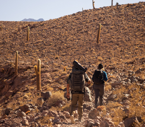
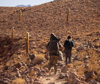
Located 60 km north of the town of San Pedro de Atacama, Puritama’s Conservation Reserve extends as an oasis of water and vegetation along the Puritama River’s course from the Altiplano to the Atacama Desert, the driest place on earth.
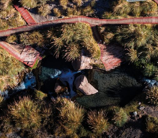
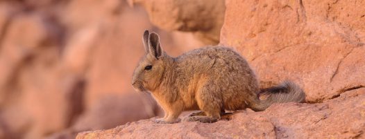
The reserve covers 7,000 hectares within the Puritama River Valley, including the Puritama hot springs. Native vegetation and the richness of flora and fauna provide refuge for numerous species, supported by long-term conservation efforts focused on iconic wildlife such as the Andean cat, puma, pampas cat, foxes, and a wide diversity of birds, as well as newly identified species of lizards and frogs.
Over the last decades, our engagement with Altiplano and Atacama reinforced our care for their territory and the people who belong and visit them. Their unique landscapes, exceptional ecosystems, and living ancestral cultures are a world’s heritage that only sustainable conservation will preserve for present and future generations. Puritama Conservation Reserve is conceived to bring people together to support and participate in a wide range of conservation projects.

Of territory protected and focused on developing sustainable tourism with an emphasis on the natural and cultural heritage of Atacama.

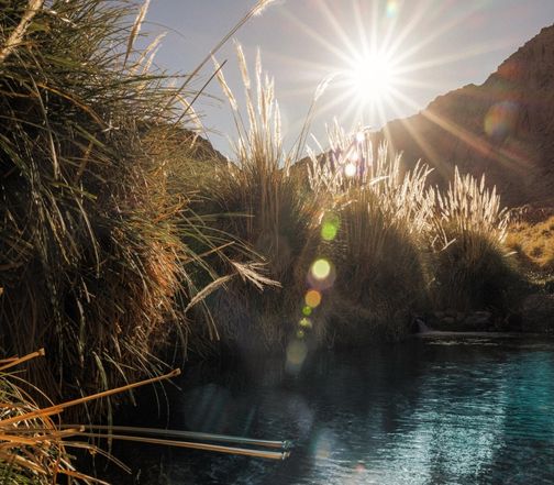
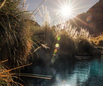
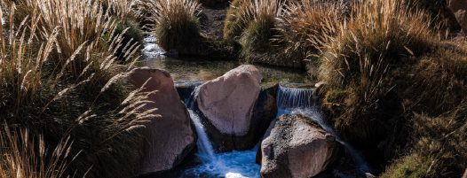
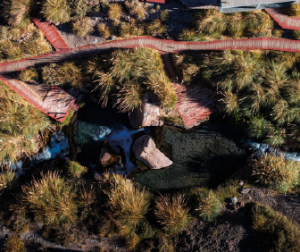
The reserve is home to ancient hot springs which water temperature remains at 28° to 31° C with an important concentration of minerals.

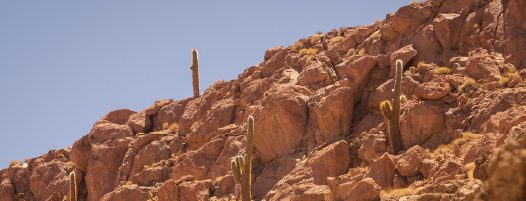
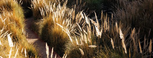
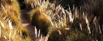
The reserve accounts for a wide range of flora considering it is located in the middle of the driest desert in the world.

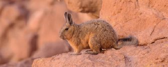
The reserve is home to a variety of birds, insects and animals among which is the Andean Cat; and iconic and endangered species monitored by Explora since 2010.
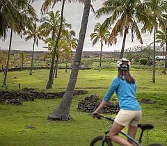
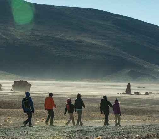
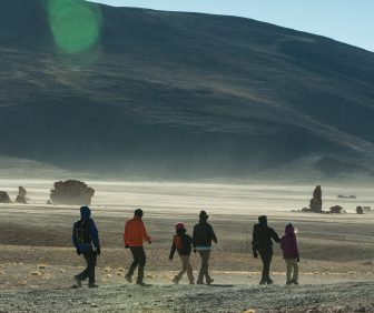
Ninety-five percent of the territory is permanently dedicated to conservation and exploration, while the remaining five percent supports carefully designed initiatives—such as tourism, research, and education—to sustain the reserve. For millennia an oasis for wildlife and people, Puritama offers a unique place to explore and restore. Flowing through a fertile canyon, the river forms natural hot springs and landscapes to discover through guided and self-guided explorations. A future Conservation Center will bring together researchers, guides, travelers, volunteers, and local communities to learn, share knowledge, and support conservation efforts.
Ninety-five percent of the territory is permanently dedicated to conservation and exploration, while the remaining five percent supports carefully designed initiatives—such as tourism, research, and education—to sustain the reserve. For millennia an oasis for wildlife and people, Puritama offers a unique place to explore and restore. Flowing through a fertile canyon, the river forms natural hot springs and landscapes to discover through guided and self-guided explorations. A future Conservation Center will bring together researchers, guides, travelers, volunteers, and local communities to learn, share knowledge, and support conservation efforts.
The reserve lies within the intermediate gorges of the rhyolitic plateau ecozone. In Puritama, a narrow corridor connecting to the Jorquencal ravine creates a direct link with the high puna, forming a distinct transition between desert lowlands and high-altitude landscapes.
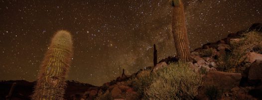
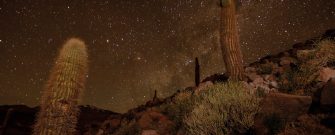
The Puritama River emerges from a geothermal source near the center of the reserve, feeding the Puritama hot springs before converging with the Puripica River near Guatín. This high-altitude desert environment is characterized by low humidity, sharp day–night temperature contrasts, seasonal summer rains, freezing winter nights, and strong southwest winds that shape the terrain through erosion.
The reserve lies within the intermediate gorges of the rhyolitic plateau ecozone. In Puritama, a narrow corridor connecting to the Jorquencal ravine creates a direct link with the high puna, forming a distinct transition between desert lowlands and high-altitude landscapes.
The Puritama River emerges from a geothermal source near the center of the reserve, feeding the Puritama hot springs before converging with the Puripica River near Guatín. This high-altitude desert environment is characterized by low humidity, sharp day–night temperature contrasts, seasonal summer rains, freezing winter nights, and strong southwest winds that shape the terrain through erosion.


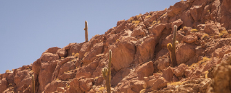
Puritama Conservation Reserve’s extreme geography creates ideal conditions for a rich and diverse Andean biodiversity. Located between 3,700 and 4,200 meters above sea level, variations in altitude, solar exposure, water availability, and substrate shape unique plant communities adapted to aridity and high radiation.
These adaptations allow flora to thrive through efficient photosynthesis, reduced water loss, and highly specialized growth strategies. This diversity of habitats also supports a wide range of fauna, including nearly 30 bird species, amphibians and reptiles associated with river and hot spring areas, and emblematic mammals such as guanacos, foxes, vizcachas, pumas, and the endangered Andean cat—one of South America’s most iconic species.
The Puritama Conservation Reserve lies within Chile’s Norte Grande, a region defined by diverse ecozones distributed across different altitudes. Each of these environments offers distinct resources that have historically complemented one another, shaping patterns of human movement, settlement, and exchange.
Seasonal climate extremes—such as cold winters in the high puna and limited vegetation availability—led populations to concentrate in intermediate plateaus, foothill oases, and fertile vegas near the Salar de Atacama. This relationship between landscape and survival has forged a deeply adaptive cultural heritage, rooted in mobility, resilience, and a profound understanding of the territory.
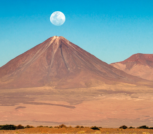
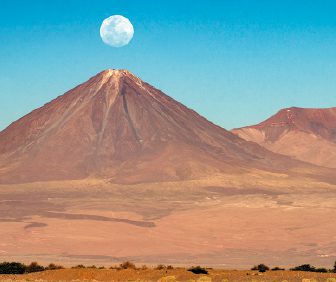
For the Atacama people, or Likan Antai, the surrounding volcanoes and mountains are sacred beings. Licancabur, Kimal, Juriques, and Lascar are not merely landmarks, but ancestral figures—volcanoes as men, mountains as women—whose stories shape the landscape.
According to legend, Licancabur and Kimal were once united, until betrayal and jealousy led to their separation across the vast salt flat. Yet every winter solstice, Licancabur’s shadow stretches more than 100 kilometers to touch Kimal’s peak, renewing their bond. This sacred moment is believed to bring fertility to the Atacama salt flat and marks the beginning of a new agricultural cycle, still celebrated today.