Torres del Paine
Patagonia, Chile
Explorations in
Torres del Paine
Activity
Difficulty
Areas
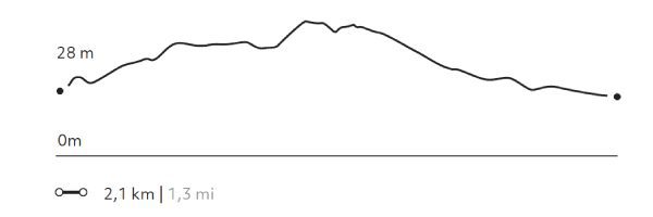
MIRADOR TORO
Encuentro
-
 Hike
Hike -
Easy
-
Half-day
We travel by van to the Weber bridge, from which we walk to Toro Lake. On the way we can observe evidence...
More details >MIRADOR TORO


-
Exploration Path
We travel by van to the Weber bridge, from which we walk to Toro Lake. On the way we can observe evidence of the ice that once covered the park. We ascend to an overlook with panoramic views. On the descent we pass by a lagoon. We return by van.
98 m 322 ft
-98 m -322 ft
83 m 272 ft
25 m 82 ftElevation Profile
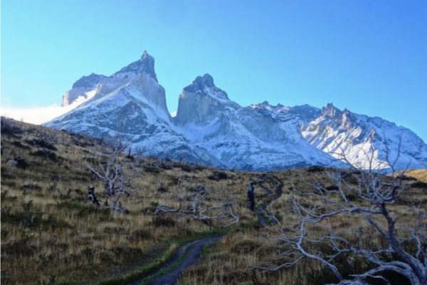
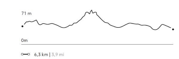
NORDENSKJÖLD
Encuentro
-
Hike
-
Easy
-
Half-day
We travel by van to Salto Grande and begin our trek with views of the Paine Grande and its hanging glaciers. Then, we reach the turquoise...
More details >NORDENSKJÖLD
-
Exploration Path
We travel by van to Salto Grande and begin our trek with views of the Paine Grande and its hanging glaciers. Then, we reach the turquoise waters of Lake Nordenskjöld, at the foot of the massif where the sound of breaking ice can occasionally be heard. We return to the lodge by van.
139 m 456 ft
-139 m -456 ft
116 m 381 ft
62 m 203 ftElevation Profile
-
Other options: