El Chaltén
Patagonia, Argentina
Explorations in
El Chaltén
Activity
Difficulty
Areas
Bahía Tranquila
Lago del Desierto
-
 Hike
Hike -
Moderate
-
Full-day
Bahía Tranquila


-
Exploration Path
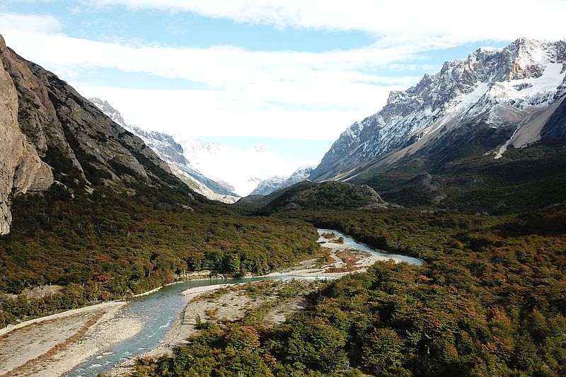
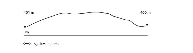
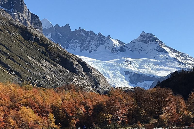
Following the Las Vueltas River amidst ancient forests, we will go to the northern area of El Chaltén. We will border the Desierto Lake, a watershed adjacent to forests and foothills of the Los Andes Mountain Range, to enjoy the views to two glaciers: Vespigniani and Huemul. Finally, we return through the same track to the van that will take us back to the lodge.
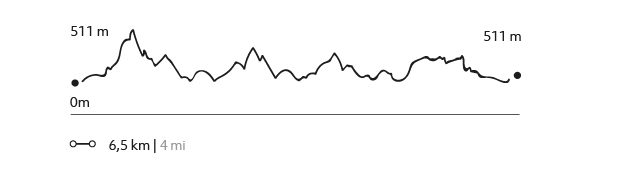
423 m 1388 ft
-415 m -1362 ft
593 m 1.946 ft
510 m 1.673 ftElevation Profile
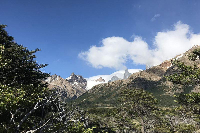
Mirador Cerro Torre
Parque Nacional Los Glaciares
-
Hike
-
Moderate
-
Full-day
In this exploration we can observe the marks of a retreating glacier and the impressive Los Andes Mountain Range.
More details >Mirador Cerro Torre
-
Exploration Path
We begin the hike from an access to the Los Glaciares National Park, taking an upward trail sided by bushes that provides ample views to the Torre Mountain. In this exploration we can observe the marks of a retreating glacier and the impressive Los Andes Mountain Range. We will also have time to photograph in detail the Patagonia landscapes and wildlife.
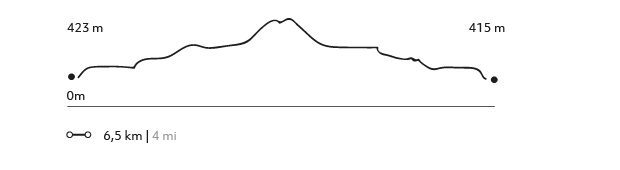
258 m 846 ft
-258 m -846 ft
613 m 2.011 ft
425 m 1.394 ftElevation Profile
Mirador Fitz Roy
Parque Nacional Los Glaciares
-
Hike
-
Moderate
-
Full-day
In the Los Glaciares National Park, we cross the forests to get a great view of the Los Andes Mountain Range’s massifs.
More details >Mirador Fitz Roy
-
Exploration Path
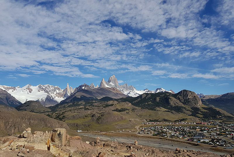
We take a van from the lodge to the Los Glaciares National Park, where we cross the forests to get a great view of the Los Andes Mountain Range’s massifs. On clear days, we can watch Mount Fitz Roy and the Agujas Mermoz and Poincenot in all their glory. Finally, we reach the viewpoint to Mount Fitz Roy, with a unique perspective of this rock formation and all the mountains around it.
481 m 1578 ft
-483 m -1585 ft
772 m 2.533 ft
397 m 1.302 ftElevation Profile
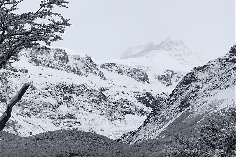
Laguna del Diablo
Los Huemules Conservation Reserve
-
Hike
-
Advanced
-
Full-day
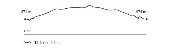
We will hike along a wooded trail overlooking the north face of Mount Fitz Roy. Our route will take us along the Diablo River, the natural habitat of torrent ducks. We will have views of the Cagliero Glacier and the Laguna del Diablo as we will go up.
More details >Laguna del Diablo

-
Exploration Path
We will hike along a wooded trail overlooking the north face of Mount Fitz Roy. Our route will take us along the Diablo River, the natural habitat of torrent ducks. We will have views of the Cagliero Glacier and the Laguna del Diablo as we will go up.
532 m 1745 ft
-525 m -1722 ft
812 m 2.664 ft
474 m 1.555 ftElevation Profile
Valle Eléctrico
Los Huemules Conservation Reserve
-
Hike
-
Moderate
-
Full-day
The splashing of the Eléctrico River will follow along faithfully during the entire exploration, as we enjoy the contrasting views.
More details >Valle Eléctrico
-
Exploration Path
We walk from the lodge to enter a forest of lenga and ñirre trees, with the company of native birds in their habitat. The splashing of the Eléctrico River will follow along faithfully during the entire exploration, as we enjoy the contrasting views offered by the valley’s glaciers and hills.
Mirador de las águilas
Parque Nacional Los Glaciares
-
Hike
-
Moderate
-
Half-day
Views to the Los Andes Mountain Range, the Viedma Lake, and surrounding mountain ranges.
More details >Mirador de las águilas
-
Exploration Path
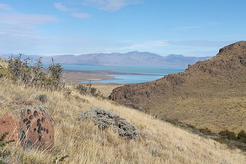
From El Chaltén we head up to the Los Glaciares National Park, with broad views to the Los Andes Mountain Range, the Viedma Lake, and surrounding mountain ranges. Shrublands and different types of birds can be sighed during the exploration.
271 m 889 ft
-271 m -889 ft
568 m 1.864 ft
396 m 1.299 ftElevation Profile
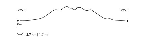
Los Cóndores
Parque Nacional Los Glaciares
-
Hike
-
Easy
-
Half-day
A walk that enters the Los Glaciares National Park with a connection and views to the Patagonia.
More details >Los Cóndores

-
Exploration Path
A walk that enters the Los Glaciares National Park with a connection and views to the Patagonia. We will enjoy breath-taking views to El Chaltén and the impressive Los Andes mountain range, while large condors follow us along the way.
155 m 509 ft
-155 m -509 ft
509 m 1.670 ft
396 m 1.299 ftElevation Profile
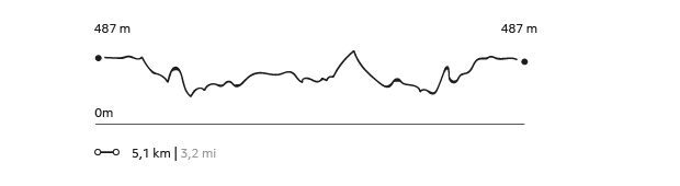
Corazón de la reserva
Los Huemules Conservation Reserve
-
Hike
-
Easy
-
Half-day
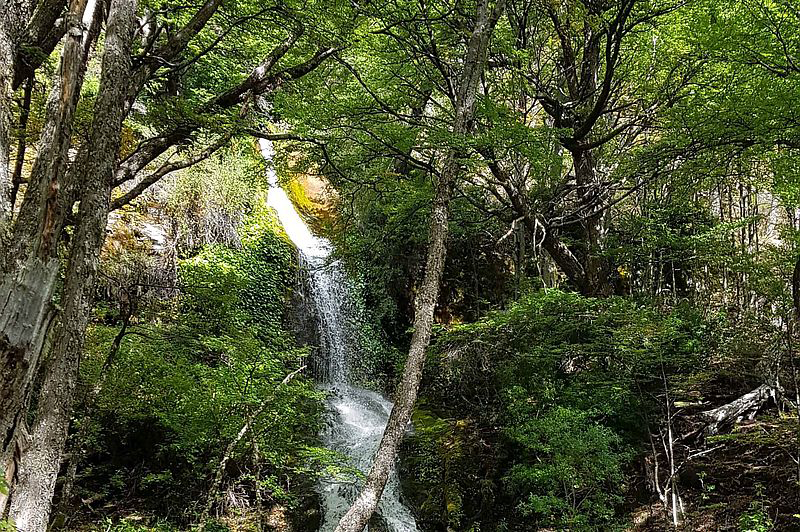
We leave the lodge on foot, where we will have a first encounter and connection with the flora and, if lucky, the native fauna of the area. This exploration is a good starting point to understand where we are located within the Los Huemules Reserve and to begin calibrating senses as we hike through ñirre and lenga forests, characteristic of this remote sector of Patagonia.
More details >Corazón de la reserva
-
Exploration Path
We leave the lodge on foot, where we will have a first encounter and connection with the flora and, if lucky, the native fauna of the area. This exploration is a good starting point to understand where we are located within the Los Huemules Reserve and to begin calibrating senses as we hike through ñirre and lenga forests, characteristic of this remote sector of Patagonia.
151 m 495 ft
-151 m -495 ft
567 m 1.860 ft
459 m 1.506 ftElevation Profile
-
Other options: