All Explorations
Areas
Activity
Difficulty
-
 E-Bike
 -
Advanced
-
Half-day
 E-Bike
  Advanced
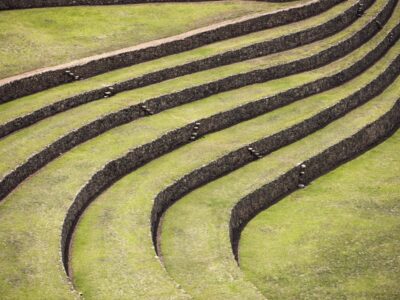
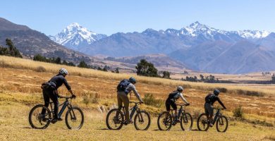
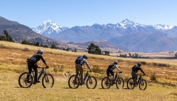
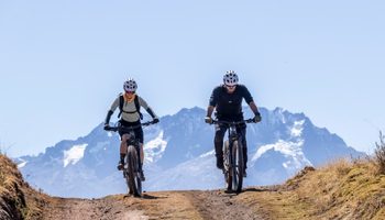
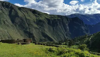
 A Signature Explora ride for experienced mountain bikers seeking a technical route beyond the Sacred Valley. Follow ancient trails alongside the majestic Apus, sacred mountains long revered in Andean tradition. Veronica, the first of nine visible peaks, rises above quiet farmlands and village life. The route descends through Moray’s circular terraces and continues to Maras, where salt pools shimmer across the mountainside. A journey through ancestral landscapes and living tradition.
VIEW DETAILS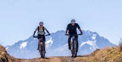
-
E-Bike
-
Easy
-
Full-day
 Easy
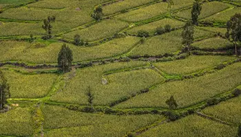
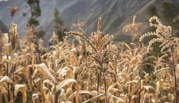
Easy Beyond the Sacred Valley, an ancient route winds through quinoa fields and eucalyptus forests, revealing a landscape where history and tradition remain alive. This e-bike journey leads to the vast agricultural terraces of Zurite, among the largest built by the Inca. Along the way, discover the colonial village of Tiobamba and its 16th-century church, where Andean artistry blends with baroque design, and take in views of the glistening salt pools of Maras, carved into the mountainside.
VIEW DETAILS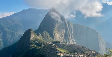
-
Hike
-
Moderate
-
Full-day
 Hike
Hike  Moderate
 Embark on an unforgettable trekking exploration along one of the world's most iconic trails. Follow in the footsteps of the ancient Incas on the famous Qhapaq Ñan, the royal road network of the Inca Empire, as you trek on foot to the legendary Machu Picchu.
VIEW DETAILS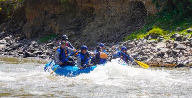
-
Combination
-
Easy
-
Full-day
 Combination
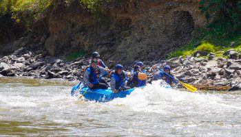
 Ideal for travelers seeking a deep connection with nature through a contrasting rafting experience, where the most vital river of The Inca Empire, The Urubamba River, sets the pace across its sacred waters.
VIEW DETAILS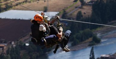
-
Climbing
-
Moderate
-
Half-day
 Climbing
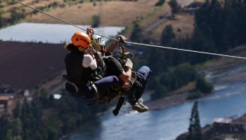
 Perfect for those seeking an active and adventurous half-day to connect with nature and the sacred mountains of the Incas. With an adrenaline rush suitable for all, this exploration offers stunning views of the northwest region of the Sacred Valley, overlooking the Urubamba River and the surrounding villages and crops.
VIEW DETAILS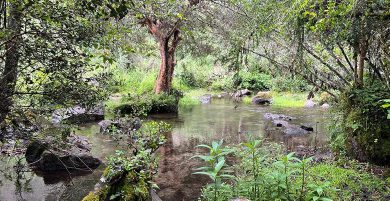
-
Hike
-
Easy
-
Half-day
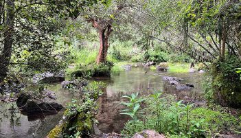
Inside Quebrada Yanahuara, following a small stream that descends from the glaciers and crosses an ancient forest, we will find tremendous biodiversity with native trees over 200 years old. After leaving the gorge we will visit Enisfera, a private reserve that preserves hummingbirds, where we will observe these beautiful birds, which are characteristic of the valley.
VIEW DETAILS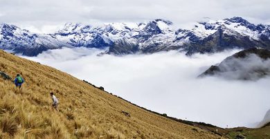
-
Hike
-
Advanced
-
Half-day
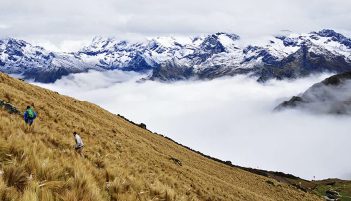
On this occasion we will be behind the massif of Pitusiray, the apu or mountain lord of Calca province, and walk along the edge of a mountain range where we will have the chance to see different lagoons and the slopes of Quebrada Calca and Quebrada Lamay, along with folds of the earth's crust that add drama to Andean geology.
VIEW DETAILS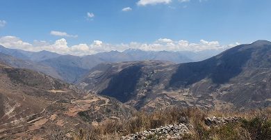
-
Hike
-
Moderate
-
Full-day
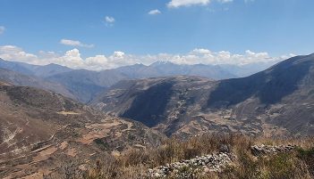
Following an old Inca road still used by the region's inhabitants to trade products between Pampa de Anta and the Sacred Valley, we go into the ravine until we reach Wata, an old ceremonial center on the mountain peak that predates the Incan era and has spectacular views of the mountain range and the Quebrada Huarocondo.
VIEW DETAILS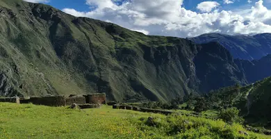
-
Combination
-
Moderate
-
Full-day
From the heights of the slopes of Sacred Valley we will descend by bicycle on a track in good condition. The journey offers...
VIEW DETAILS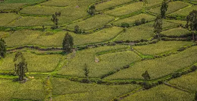
-
Bike
-
Expert
-
Full-day
 Expert
 The exploration begins in the heights of the pampas and then descends – over a vehicle road – among Quechua communities and farmlands...
VIEW DETAILS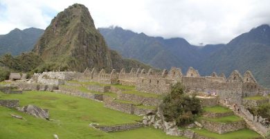
-
Overland
-
Easy
-
Full-day
 Overland
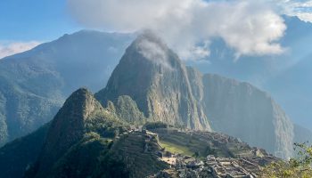
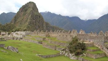
 We explore the famous historical sanctuary of Machu Picchu, one of the most impressive architectural expressions of the Inca civilization.
VIEW DETAILS
-
Overland
-
Easy
-
Full-day
This exploration shows the best of Cusco in one day. We will descend from the fortress of Saqsaywaman down crossing the al leys...
VIEW DETAILS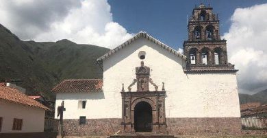
-
Overland
-
Easy
-
Full-day
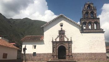
We will explore the Spanish influence through art and the religious syncretism that the cultural encounter fostered. We begin with a visit to the first of the three Canicunca churches, before walking to the Huaro church and then heading to the Andahuaylillas church, where we will visit the choir and the museum. We will end with lunch in a wetland accompanied by native birds.
VIEW DETAILS
-
Overland
-
Easy
-
Full-day
This route first takes us to Ollantaytambo, also known as the “living Inca city”. From there we travel to the archaeological site of Moray...
VIEW DETAILS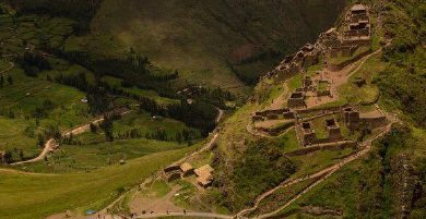
-
Overland
-
Easy
-
Half-day
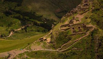
Known for its remarkable ruins, as well as for its colorful crafts market, the village of Pisac bears witness to the accomplishments and mysteries...
VIEW DETAILSDiscover Our Destinations
Endless revelations and possibilities await.