Sacred Valley
All Explorations
Filter By:
Areas
Activity
Difficulty
Areas
Activity
Difficulty
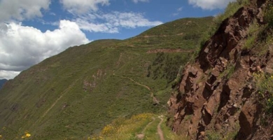
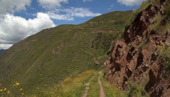
Huayna Kolka
Suni
-
 Bike
Bike -
Moderate
-
Half-day
 Bike
Bike  Moderate
 After visiting the archaeological site of Machu Kolka, we get on our bikes and begin a descent among trees and adobe houses towards...
VIEW DETAILS
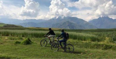
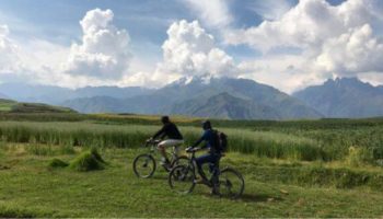
Huaypo Views
Suni
-
Bike
-
Advanced
-
Full-day
 Advanced
 This exploration crosses the farmlands of Chinchero, visiting small farms and villages. It takes the traveler...
VIEW DETAILS
Book the trip of a lifetime!
Discover Our Destinations
Endless revelations and possibilities await.