All Explorations
Areas
Activity
Difficulty
-
 High Mountain Ascent
 -
Expert
-
Full-day
 High Mountain Ascent
  Expert
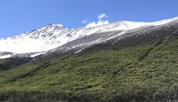
 The ascent to Cerro Madsen, in the Fitz Roy area, is a perfect challenge for beginners in the mountains or for those who want to make their first summit in Patagonia.
VIEW DETAILS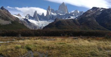
-
Hike
-
Expert
-
Full-day
 Hike
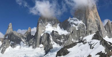
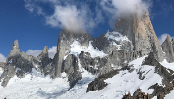
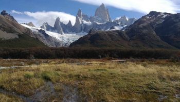
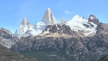
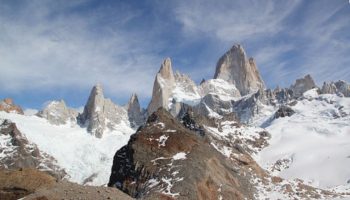
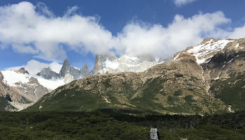
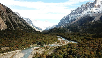
Hike We cross the Blanco river valley, then we hike up to the los tres lagoon. Enjoy an impressive view of Mount Fitz Roy.
VIEW DETAILS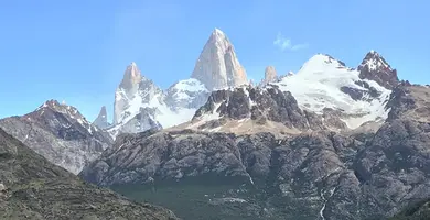
-
Hike
-
Advanced
-
Full-day
 Advanced
 We hike in the northernmost tip of the lake and take a rugged track through the forest, reaching some of the most unexplored parts of this area.
VIEW DETAILS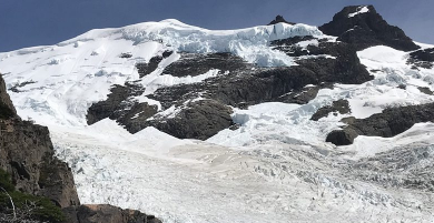
-
Hike
-
Advanced
-
Full-day
We cross the desierto lake- this historical lake- while enjoying the view of the Vespigniani Glacier.
VIEW DETAILS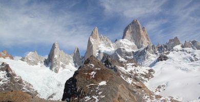
-
Hike
-
Advanced
-
Full-day
We hike through forests and valleys up to the Los Tres Lagoon.
VIEW DETAILS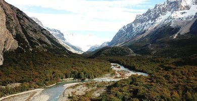
-
Hike
-
Advanced
-
Full-day
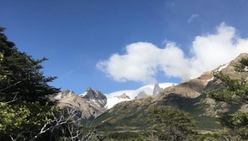
We begin in the south area of the Los Glaciares National Park, taking a trail to different valleys and a rise with a broad view to the Torre Mount.
VIEW DETAILS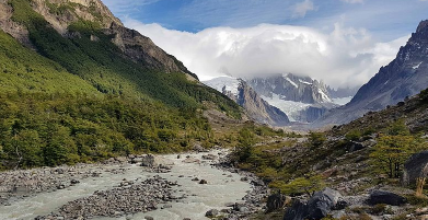
-
Hike
-
Advanced
-
Full-day
From one of the accesses to El Chaltén, we hike up a trail and get an ample view to the Torre Mount.
VIEW DETAILS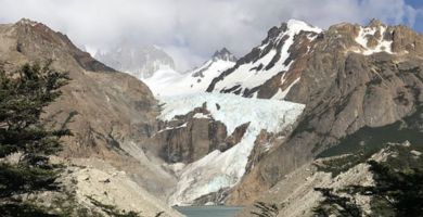
-
Hike
-
Moderate
-
Half-day
 Moderate
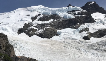
 After a hike, we enjoy a view to the Piedras Blancas Glacier while learning about its history, formation, and dynamics.
VIEW DETAILS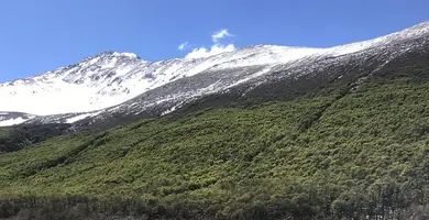
-
Hike
-
Advanced
-
Full-day
We take a slightly rugged track from the lodge to the Azul lagoon.
VIEW DETAILS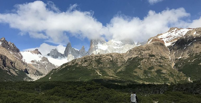
-
Hike
-
Moderate
-
Full-day
We walk to the Los Glaciares National Park through a trail surrounded by forests with views to the area’s glaciers.
VIEW DETAILS
-
Hike
-
Advanced
-
Full-day
We begin this exploration hiking up the Loma del Diablo ridge, which will give us sweeping views of both the Diablo River valley as well as the Las Vueltas River valley. We will reach a high-altitude ecosystem with a dwarf forest, rocks and sandy banks, where we can register the magnitude of the environment we are in.
VIEW DETAILS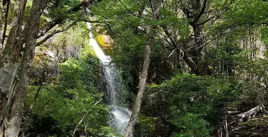
-
Hike
-
Moderate
-
Full-day
We will border the Desierto Lake, a watershed adjacent to forests.
VIEW DETAILS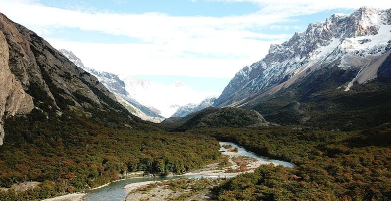
-
Hike
-
Moderate
-
Full-day
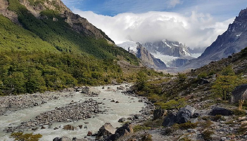
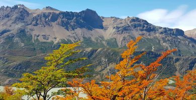
In this exploration we can observe the marks of a retreating glacier and the impressive Los Andes Mountain Range.
VIEW DETAILS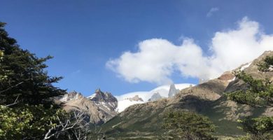
-
Hike
-
Moderate
-
Full-day
In the Los Glaciares National Park, we cross the forests to get a great view of the Los Andes Mountain Range’s massifs.
VIEW DETAILS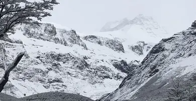
-
Hike
-
Advanced
-
Full-day
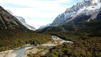
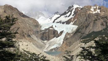
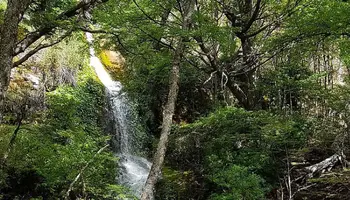
We will hike along a wooded trail overlooking the north face of Mount Fitz Roy. Our route will take us along the Diablo River, the natural habitat of torrent ducks. We will have views of the Cagliero Glacier and the Laguna del Diablo as we will go up.
VIEW DETAILSDiscover Our Destinations
Endless revelations and possibilities await.